JISAO data

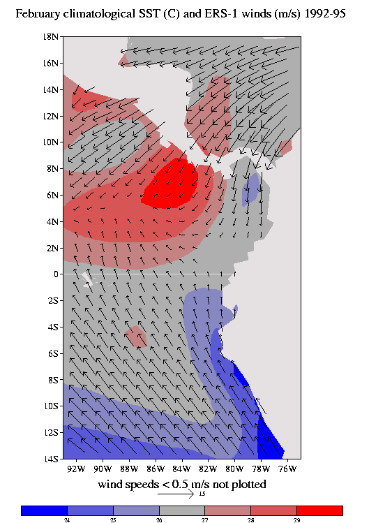
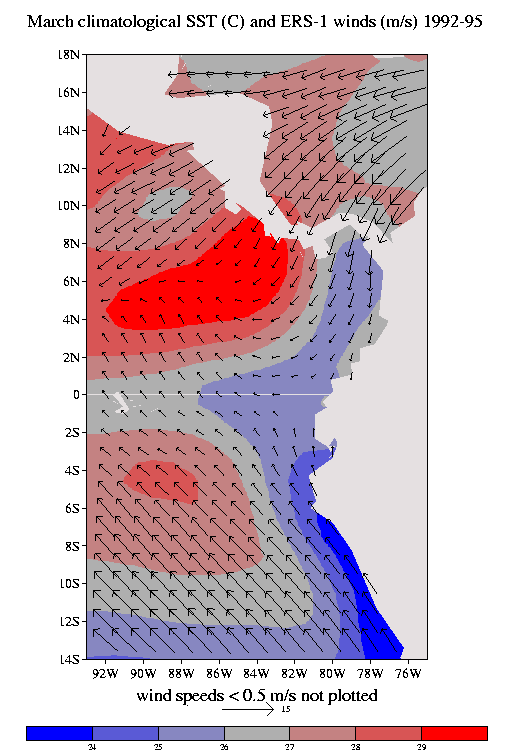
European Remote-sensing Satellite (ERS-1) 10-m Vector Wind, 1992-95

Analyses | Data


The winds were time-spaced filtered and averaged into 1-degree latitude-longitude regions by
Lixin Zeng, with the time-space filtering employed to remove spurious features associated with sampling (Zeng and Levy, 1995, J. Geophys. Res.,100,5133-5142).


The figure depicts December 1992 10-m wind and sea surface temperature. Mountain regions shaded.

Domain
shown ...
PostScript | JPEG

Domain
shown ...
PostScript | JPEG


Data in netCDF format.
At JISAO, these data sets reside at /home/disk/tao/data/ers/
Monthly zonal winds. (4.2 Mb)
Monthly meridional winds. (4.2 Mb)
Climatologies:
Maps 1-12: January, February, ...;
map 13: annual mean (all calendar months required to contribute)
maps 14-17: December-January-February, March-April-May, ...
Zonal wind climatology for 1992-95
Meridional wind climatology for 1992-95
NCEP optimal interpolation sea surface temperature climatology for 1992-95


March 2001
Todd Mitchell (mitchell@atmos.washington.edu)
JISAO data