Data:
Note 1: The GPCP algorithms are always being updated so you are advised to check the GPCP WWW page to make sure that you are getting the latest and greatest version of this data set.
Note 2: Error fields for the preciptation estimates are also available at the GPCP WWW page.
i) Precipitation rate (mm/day), obtained from NOAA ESRL
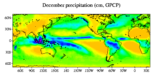
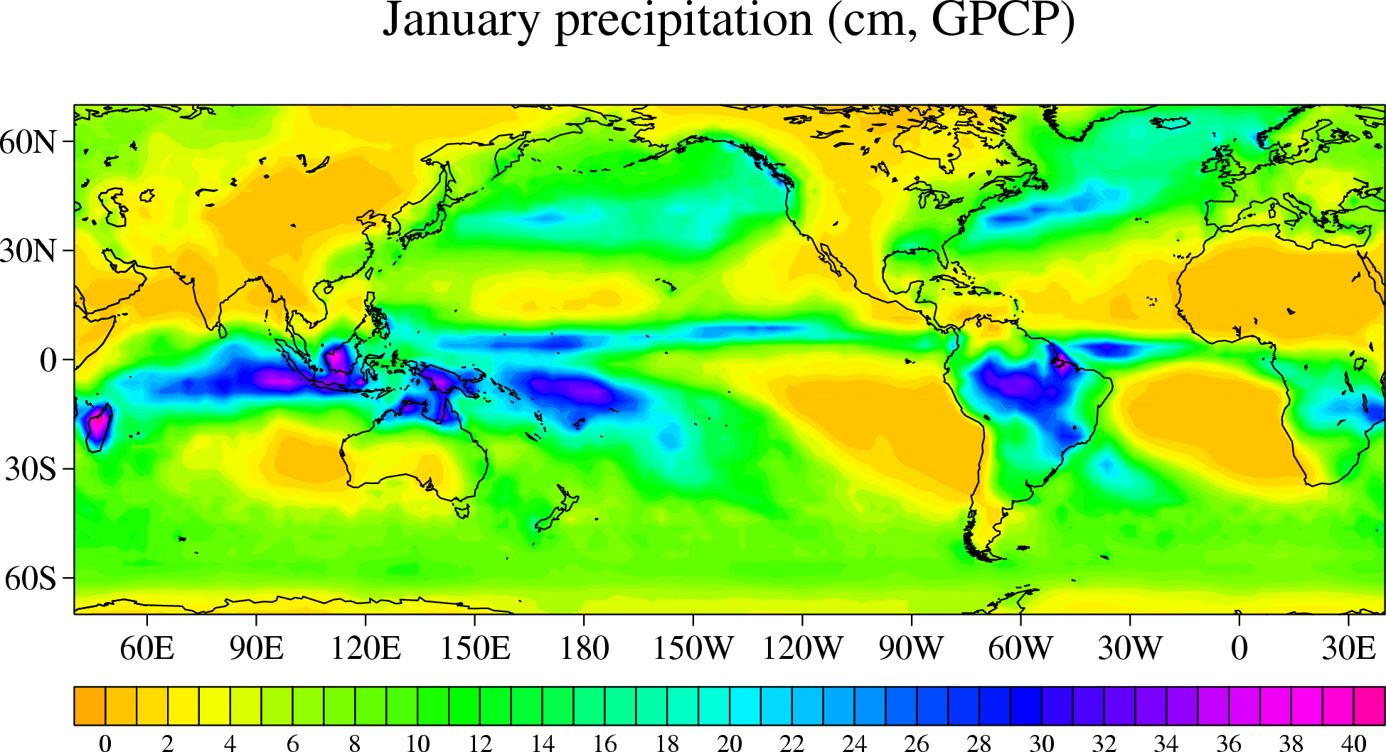
ii) precitation amount (cm/month)
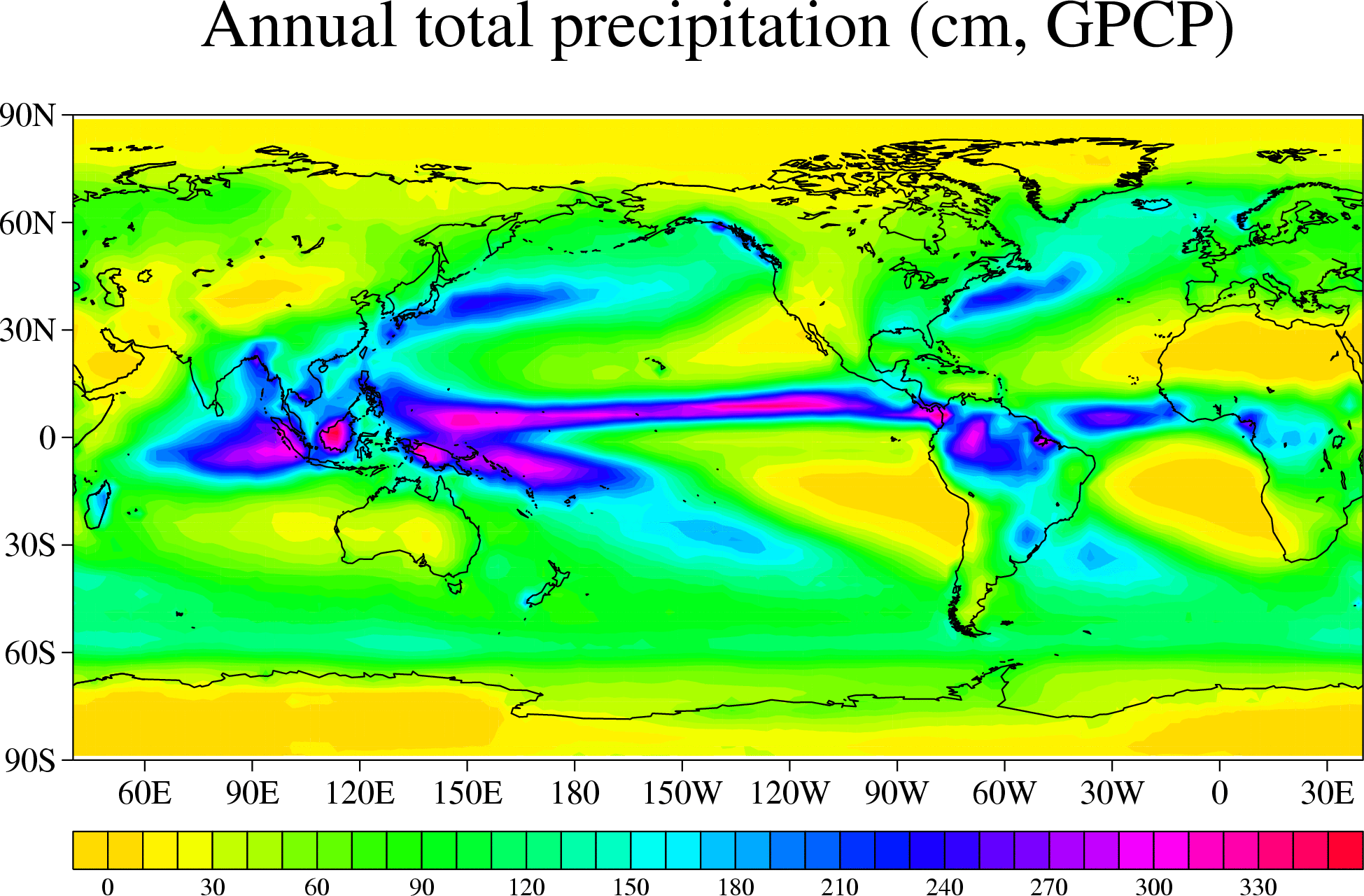
iii) 1979-2004 climatology Maps 1-12: January, February, ...; map 13: annual mean; maps 14-17 December-January-February, March-April-May, ...
iv) The rain gauge component of GPCP.
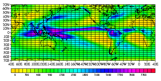
Same figure, but with a grid.
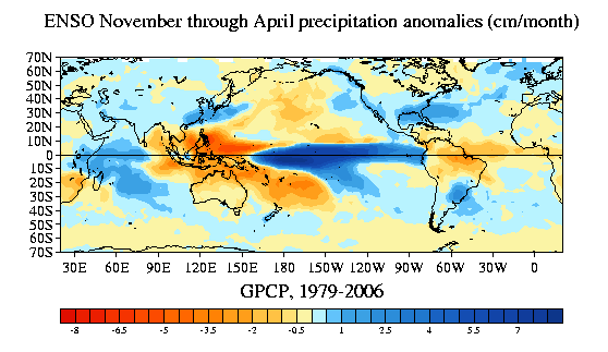
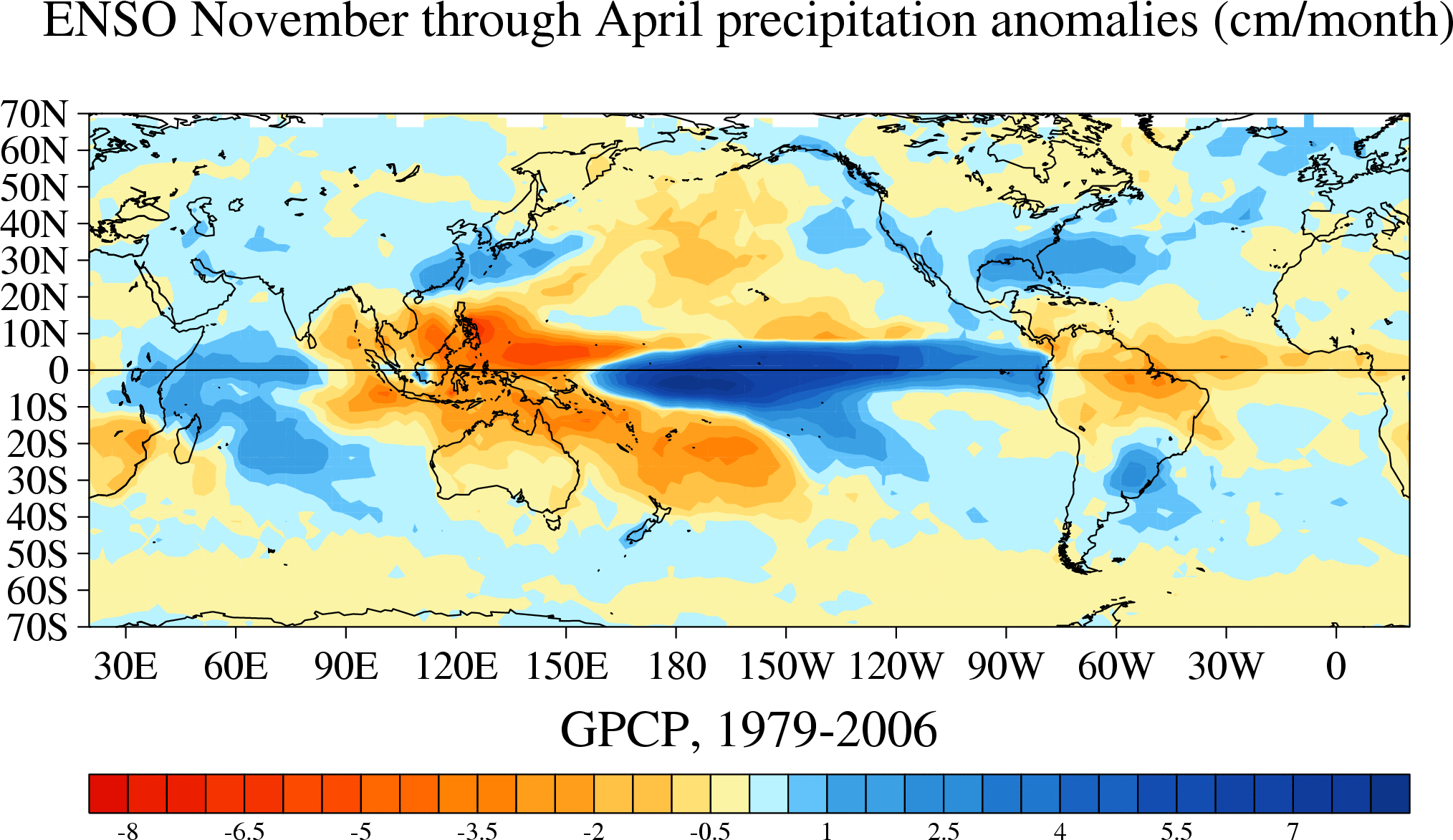
The same analysis for just November through April (Northern Hemisphere
extratropics cold season)
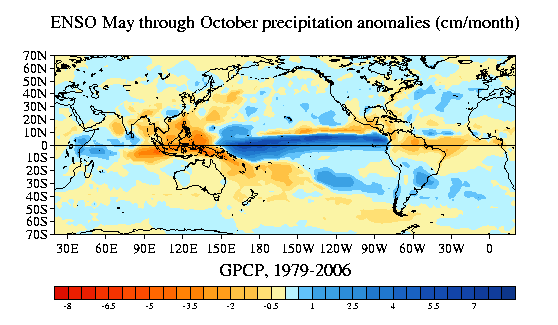
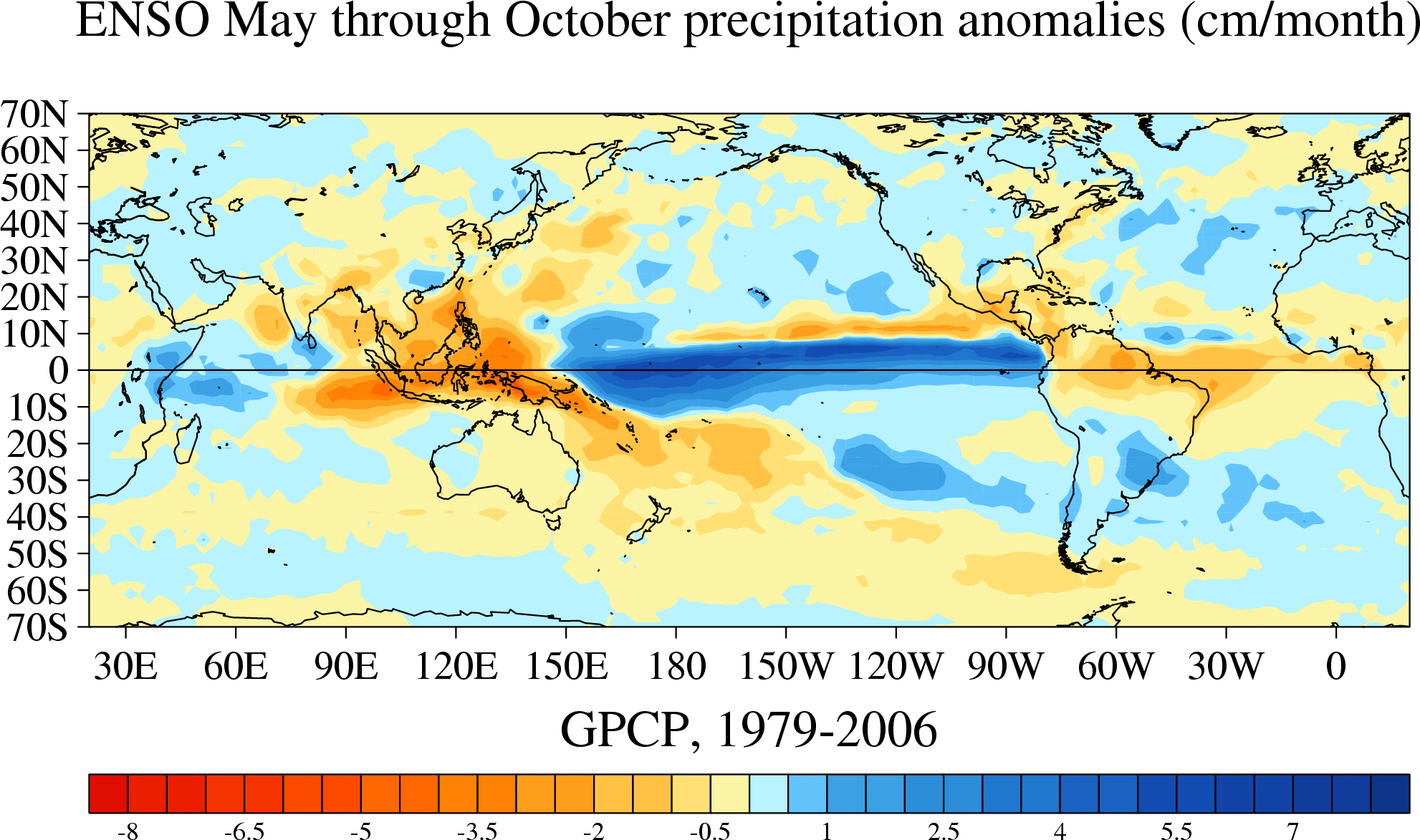
The same analysis for just May through October (Northern Hemisphere
extratropics warm season)
big GIF |
PDF | PS
digital values in a netCDF
file
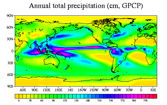
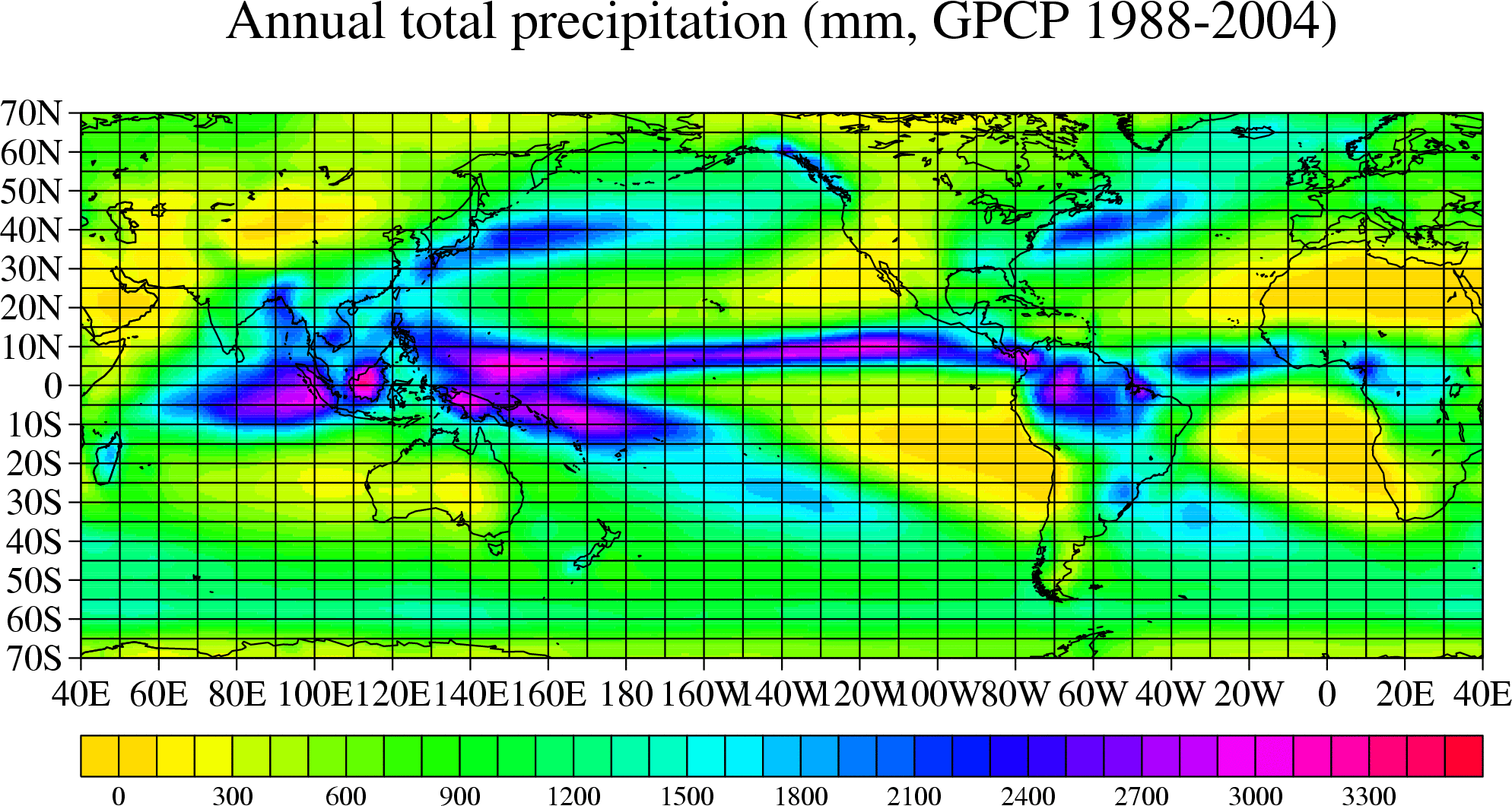
The above figure is derived from 1988-2004 data.
big GIF |
PDF | PS
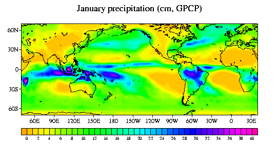
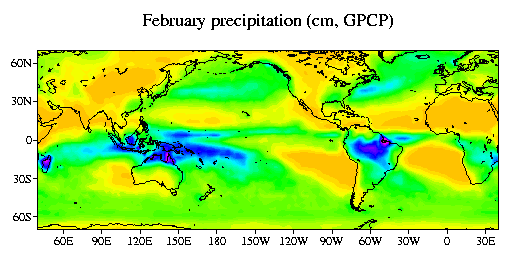
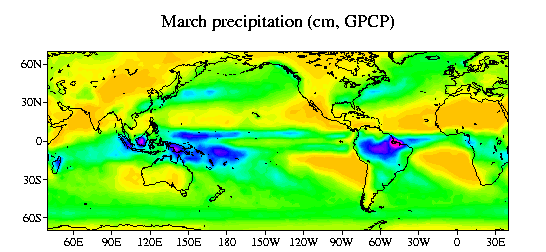
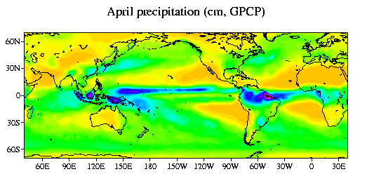
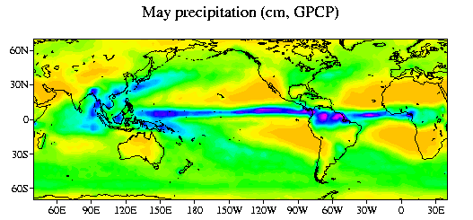
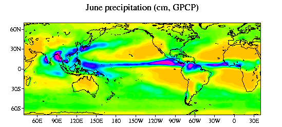
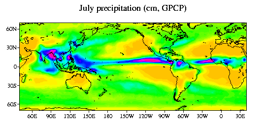
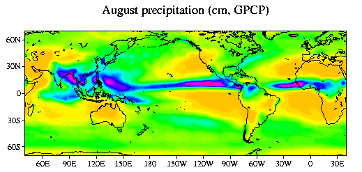
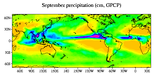
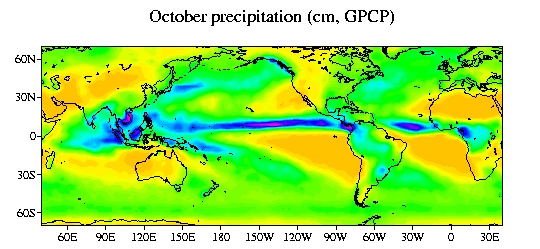
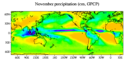
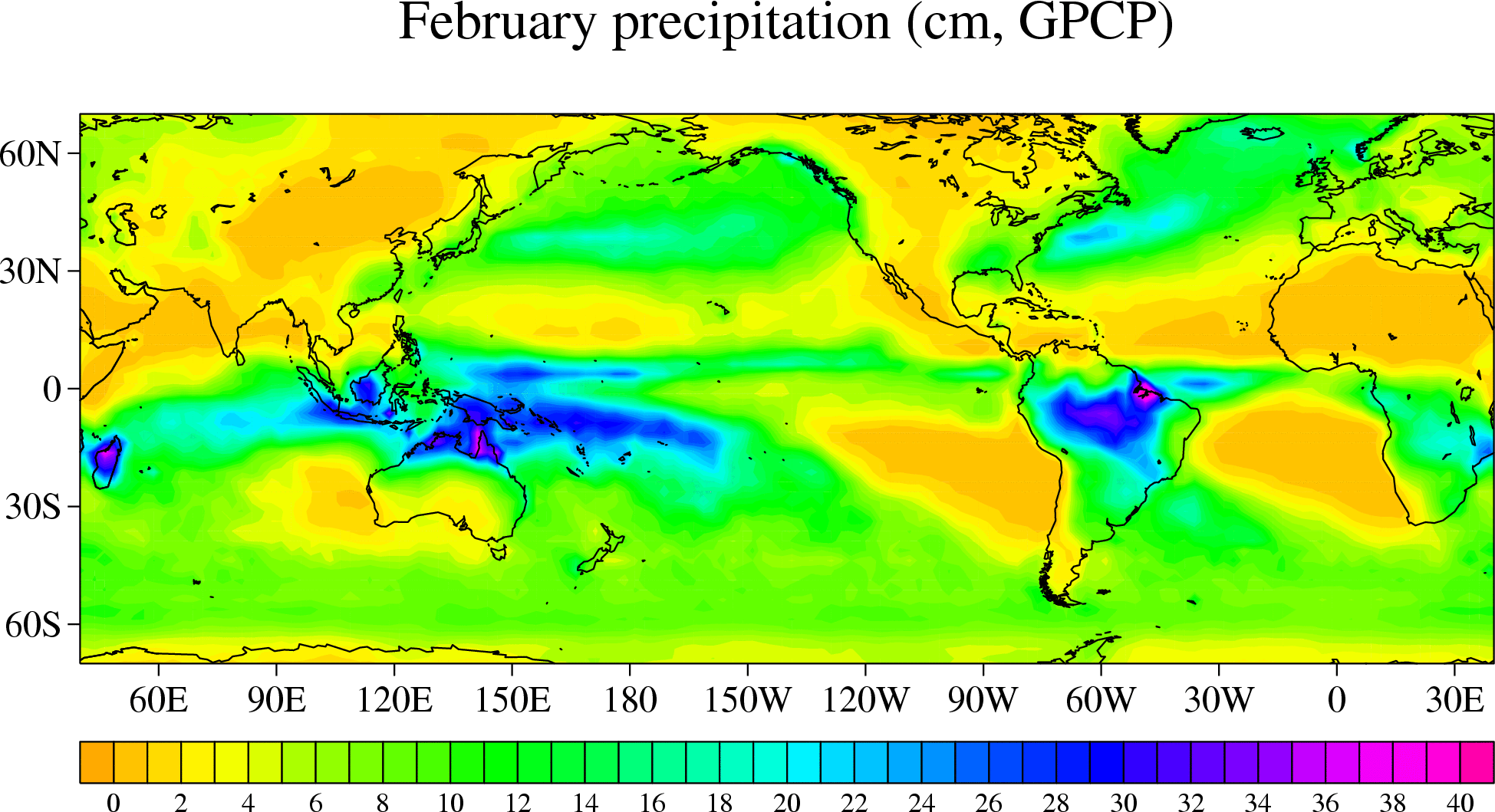
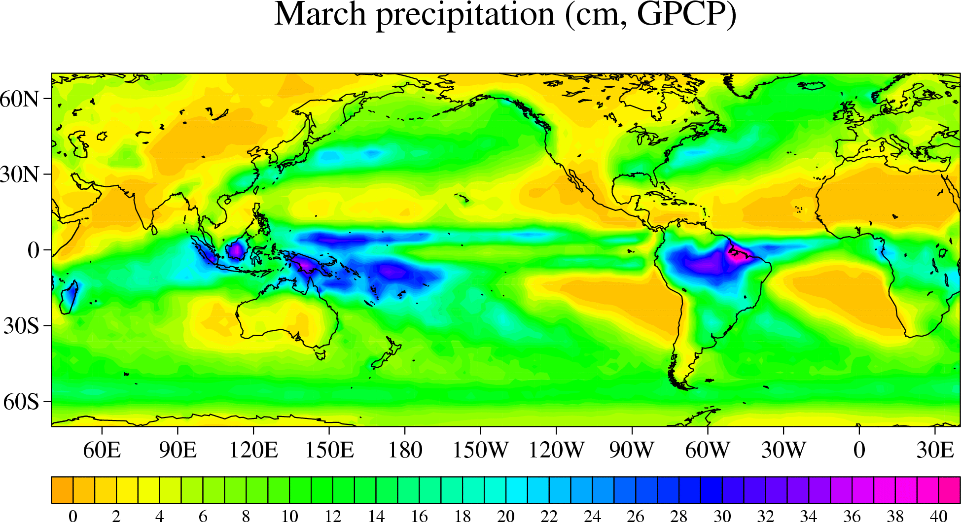
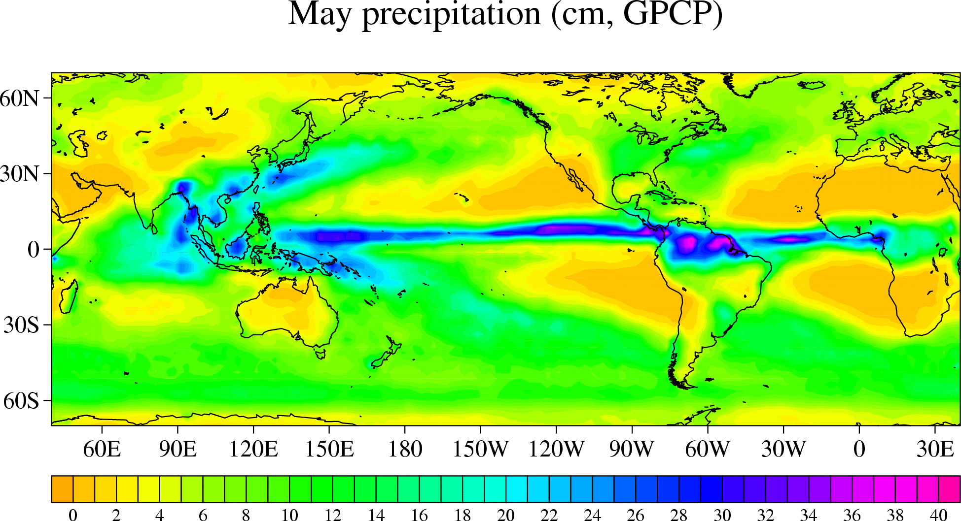
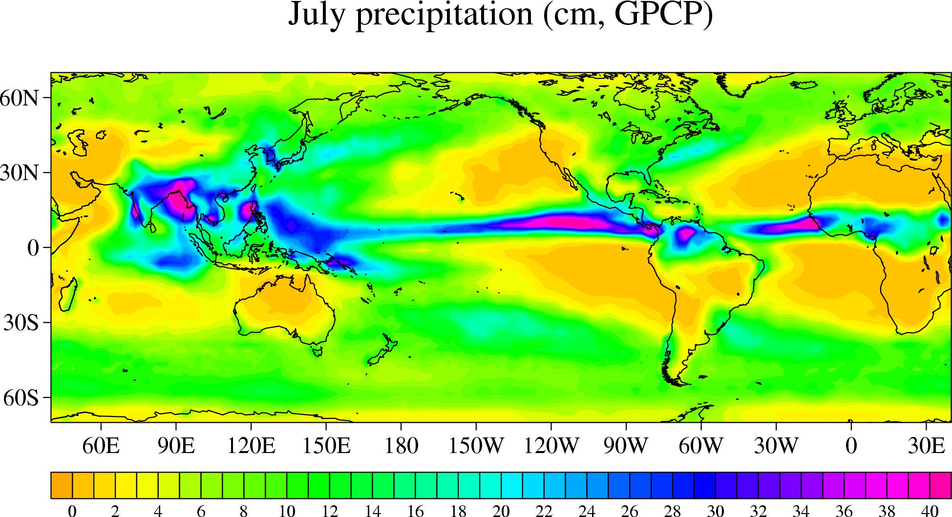
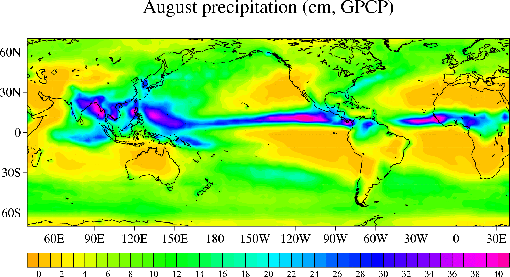
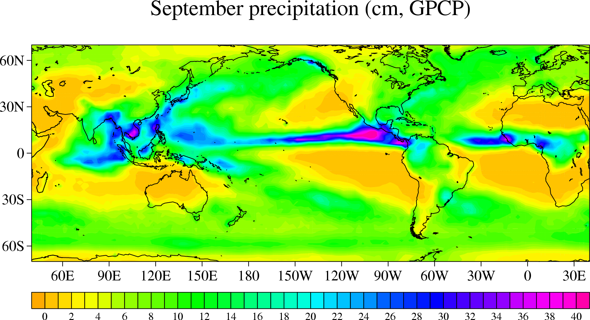
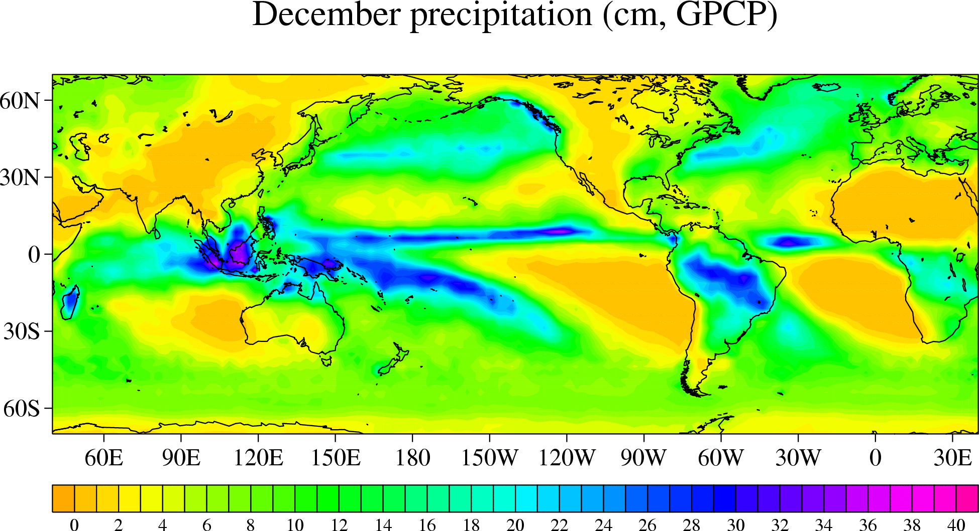
The following are the individual monthly climatologies derived for
1988-2004.
digital values in a netCDF
file (12 maps) | PDF file of the monthly
analyses
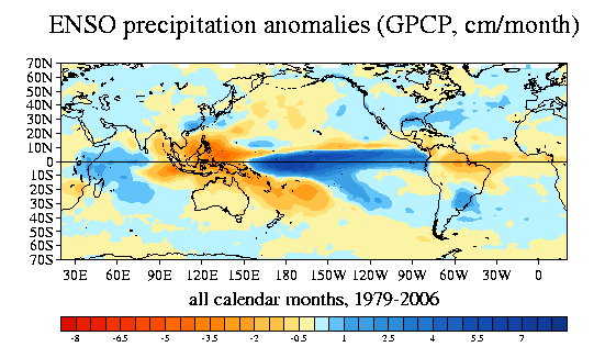
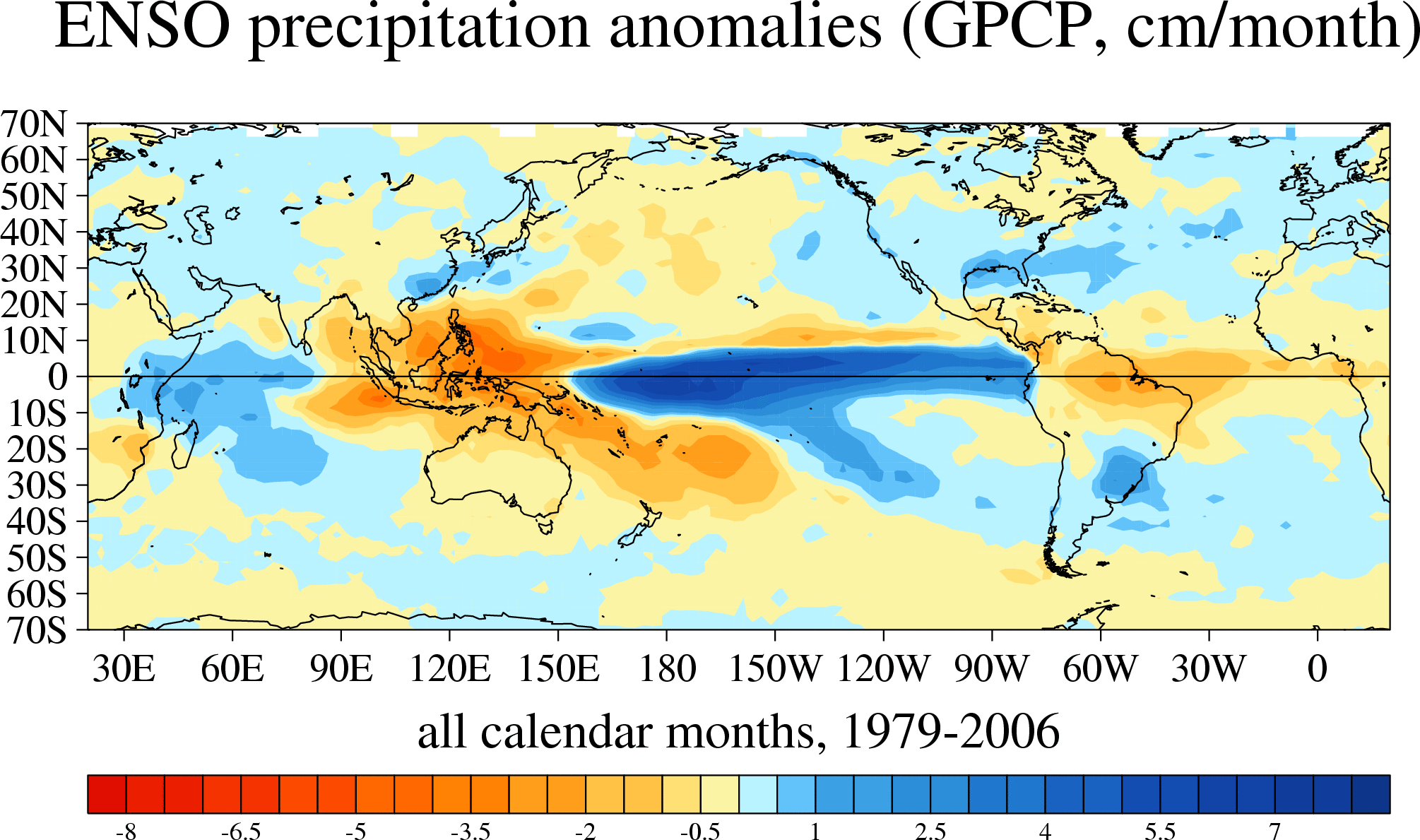
Typical ENSO precipitation anomalies for all calendar months combined
big GIF |
PDF | PS
big GIF |
PDF | PS
big GIF |
PDF | PS
map 1: precipitation correlation with ENSO index (cold tongue index (CTI),
similar to Nino 3.4 SST), all calendar months combined
map 2: preciptation regressed onto standard CTI (cm/month), all
calendar months combined
maps 3 and 4: as in 1 and 2, but for November through April months
maps 5 and 6: as in 1 and 2, but for May through October months