PostScript | JPEG
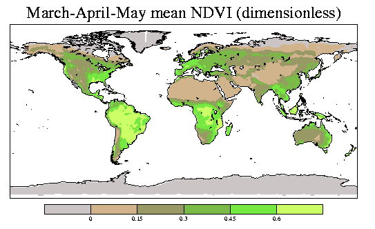
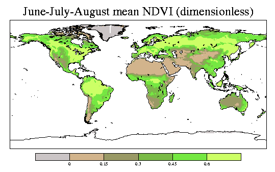
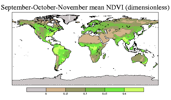
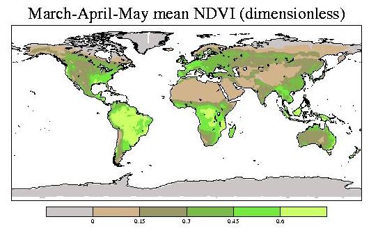
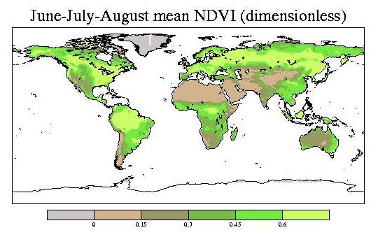
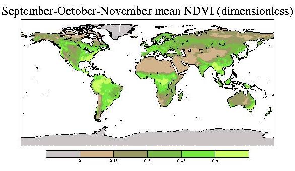
The normalized difference vegetation index (NDVI) is an estimate of the photosynthetically absorbed radiation over the land surfaces. A more thorough definition and references are provided in this link.
This NDVI record and future updates are available through the NASA Goddard Space Flight Center Earth Sciences distributed active archive center. That WWW site provides the NDVI data in a variety of spatial and temporal resolutions. The version of the data on the present WWW page is the 1-degree latitude-longitude resolution monthly mean data that was obtained from the above URL. I calculated the netCDF file of this data and of a climatology calculated for 1982-2000. The data begins in July 1981 and was last updated through September 2001. There were no observations in September through December 1994.
The SeaWiFS WWW page provides 4-km resolution images of the NDVI for individual months and seasons. They are very beautiful!
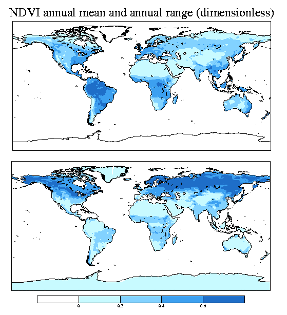
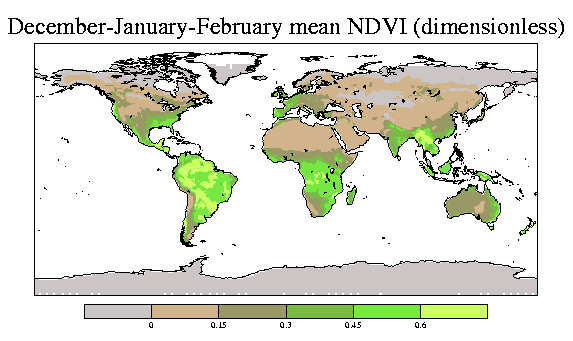
The following analyses are for a 1982-2000 climatology.
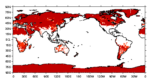
There are some grid boxes with negative values of the NDVI. These may be snow and they may be contamination. The grid boxes that ever have negative NDVI values are shown below.
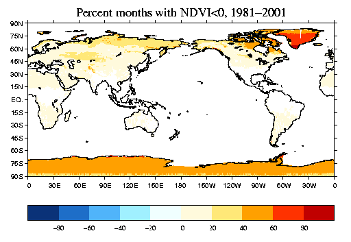
The percentage of months in July 1981 through August 1994 and January 1995 through September 2001 with negative NDVI values.
Data: