This data set is being replaced by the extended reconstructed sea surface temperature (ERSST) data set. I'm am not sure how often they are going to update the ERSST.
Tom Smith, Dick Reynolds, and collaborators at the NOAA NCEP Climate
Modeling Branch (CMB) produced an SST data set that has been
smoothed and filled with EOFs. In the past, Dick Reynolds has
suggested that people use the Optimal Interpolation SST analysis for
the period 1982-present. In late 1999, however, I noticed that they are now
updating this data set up to the present. This data set is now being
updated annually.
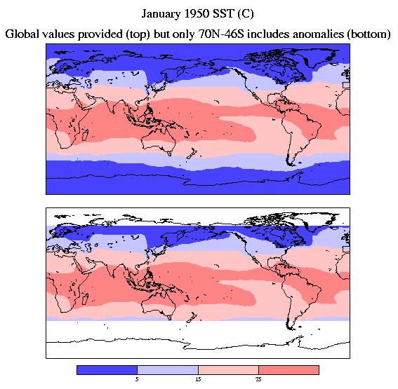
Anomalies are calculated for the latitude range 70N-46S and the higher
latitude anomalies are set to zero. Land grid points within 70N-46S are also given
anomaly values. The anomalies are then added to a climatology to
provide a total SST field. The January 1950 map is shown below to
illustrate these points.
Data:
Documentation and reference:
Documentation
Smith, T. M., R. W. Reynolds, R. E. Livezey, and
D. C. Stokes, 1996: Reconstruction of historical sea surface
temperatures using empirical orthogonal functions. J. Climate,
9, 1403-1420.
Thomas Smith (Tom.Smith@noaa.gov)
Richard Reynolds (Richard.W.Reynolds@noaa.gov)