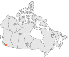
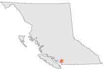
1047660 - SQUAMISH, British Columbia

Latitude
49° 42´N
Longitude
123° 8´W
Elevation
31 meters

Canada

British Columbia
Help

Main
10 nearest Canadian stations
29 kmW :CLOWHOM FALLS, BC
29 kmSSW :VICTORIA PHYLLIS STREET, BC
32 kmSSE :SEYMOUR FALLS, BC
44 kmS :VANCOUVER HARBOUR CS, BC
48 kmSSE :IOCO REFINERY, BC
50 kmSSE :BURNABY MTN TERMINAL, BC
57 kmS :VANCOUVER INT'L A, BC
73 kmNNE :PEMBERTON A, BC
76 kmSE :STAVE FALLS, BC
80 kmSW :NANAIMO DEPARTURE BAY, BC

Weather variables    Help
Click a weather variable name to jump down to those statistics.
Total
observations
%
NDJFM
observations
%
TMAX
0
0.0%
0
0.0%
TMIN
0
0.0%
0
0.0%
TEMP
0
0.0%
0
0.0%
PRCP
17788
97.4%
7318
96.8%
SNOW
17845
97.7%
7328
96.9%
RAIN
17792
97.4%
7322
96.8%


TMAX     top of page

No TMAX observations during NDJFM over 1948-1997


TMIN     top of page

No TMIN observations during NDJFM over 1948-1997


TEMP     top of page

No TEMP observations during NDJFM over 1948-1997


PRCP (liquid water equivalent)     Help     top of page

PRCP
observations
mean
   
Distribution
during extreme days of
NDJFM
7318  by year
9.0 mm
   
overall
NAM
PNA
CTI

PRCP and NAM    Help
scatterplot
days
by month
mean
mean
NAM index
extreme high
NAM days
extreme low
NAM days
ratio of extreme
high:low NAM days
Observed events
Days with PRCP>0.0 mm
4263
15.5 mm
0.01
691
686
1.0
map
table
Extreme events
Days with PRCP>25.3 mm
847
42.8 mm
0.10
150
117
1.3
map
table

PRCP and PNA    Help
scatterplot
days
by month
mean
mean
PNA index
extreme high
PNA days
extreme low
PNA days
ratio of extreme
high:low PNA days
Observed events
Days with PRCP>0.0 mm
4263
15.5 mm
-0.03
672
706
1.1
map
table
Extreme events
Days with PRCP>25.3 mm
847
42.8 mm
0.14
150
102
1.5*
map
table

PRCP and CTI    Help
days
by month
mean
high CTI days
(moderate to strong
El Niño winters)
low CTI days
(moderate to strong
La Niña winters)
ratio of high:low CTI
(El Niño:La Niña days)
Observed events
Days with PRCP>0.0 mm
4263
15.5 mm
715
776
1.1*
map
table
Extreme events
Days with PRCP>25.3 mm
847
42.8 mm
146
156
1.1
map
table

PRCP under 2 index extremes     Help
Station table Maps - choose one extreme:
High NAMLow NAM High PNALow PNA High CTILow CTI


SNOW (liquid water equivalent)     Help     top of page

SNOW
observations
mean
   
Distribution
during extreme days of
NDJFM
7328  by year
0.7 mm
   
overall
NAM
PNA
CTI

SNOW and NAM    Help
scatterplot
days
by month
mean
mean
NAM index
extreme high
NAM days
extreme low
NAM days
ratio of extreme
high:low NAM days
Observed events
Days with SNOW>0.0 mm
859
5.8 mm
0.00
153
160
1.0
map
table
Extreme events
Days with SNOW>10.3 mm
171
18.3 mm
-0.25
18
37
2.1*
map
table

SNOW and PNA    Help
scatterplot
days
by month
mean
mean
PNA index
extreme high
PNA days
extreme low
PNA days
ratio of extreme
high:low PNA days
Observed events
Days with SNOW>0.0 mm
859
5.8 mm
-1.09
21
371
17.7*
map
table
Extreme events
Days with SNOW>10.3 mm
171
18.3 mm
-1.40
2
95
47.5*
map
table

SNOW and CTI    Help
days
by month
mean
high CTI days
(moderate to strong
El Niño winters)
low CTI days
(moderate to strong
La Niña winters)
ratio of high:low CTI
(El Niño:La Niña days)
Observed events
Days with SNOW>0.0 mm
859
5.8 mm
105
208
2.0*
map
table
Extreme events
Days with SNOW>10.3 mm
171
18.3 mm
29
39
1.3
map
table

SNOW under 2 index extremes     Help
Station table Maps - choose one extreme:
High NAMLow NAM High PNALow PNA High CTILow CTI


RAIN     Help     top of page

RAIN
observations
mean
   
Distribution
during extreme days of
NDJFM
7322  by year
8.3 mm
   
overall
NAM
PNA
CTI

RAIN and NAM    Help
scatterplot
days
by month
mean
mean
NAM index
extreme high
NAM days
extreme low
NAM days
ratio of extreme
high:low NAM days
Observed events
Days with RAIN>0.0 mm
3830
15.9 mm
0.04
631
582
1.1
map
table
Extreme events
Days with RAIN>25.9 mm
766
43.9 mm
0.09
135
105
1.3
map
table

RAIN and PNA    Help
scatterplot
days
by month
mean
mean
PNA index
extreme high
PNA days
extreme low
PNA days
ratio of extreme
high:low PNA days
Observed events
Days with RAIN>0.0 mm
3830
15.9 mm
0.13
668
475
1.4*
map
table
Extreme events
Days with RAIN>25.9 mm
766
43.9 mm
0.22
145
78
1.9*
map
table

RAIN and CTI    Help
days
by month
mean
high CTI days
(moderate to strong
El Niño winters)
low CTI days
(moderate to strong
La Niña winters)
ratio of high:low CTI
(El Niño:La Niña days)
Observed events
Days with RAIN>0.0 mm
3830
15.9 mm
663
666
1.0
map
table
Extreme events
Days with RAIN>25.9 mm
766
43.9 mm
129
147
1.1
map
table

RAIN under 2 index extremes     Help
Station table Maps - choose one extreme:
High NAMLow NAM High PNALow PNA High CTILow CTI