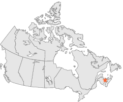
8103200 - Moncton A, New Brunswick

Latitude
46° 7´N
Longitude
64° 41´W
Elevation
71 meters

Canada

New Brunswick
Help

Main
10 nearest Canadian stations
8 kmWSW :MONCTON, NB
38 kmSE :SACKVILLE, NB
51 kmSE :NAPPAN CDA, NS
62 kmNNW :REXTON, NB
74 kmENE :SUMMERSIDE A, PE
80 kmSW :SUSSEX, NB
84 kmSSE :PARRSBORO, NS
116 kmNNW :CHATHAM A, NB
118 kmS :Kentville CDA CS, NS
118 kmS :KENTVILLE CDA, NS

Weather variables    Help
Click a weather variable name to jump down to those statistics.
Total
observations
%
NDJFM
observations
%
TMAX
18262
100.0%
7563
100.0%
TMIN
18262
100.0%
7563
100.0%
TEMP
18262
100.0%
7563
100.0%
PRCP
0
0.0%
0
0.0%
SNOW
0
0.0%
0
0.0%
RAIN
0
0.0%
0
0.0%


TMAX     Help     top of page

TMAX
observations
mean
std dev
   
Distribution
during extreme days of
NDJFM
7563  by year
0.1°C
6.9°C
   
overall
NAM
PNA
CTI

TMAX and NAM    Help
scatterplot
days
by month
mean
NAM index
extreme high
NAM days
extreme low
NAM days
ratio of extreme
high:low NAM days
Extreme high events
Days with TMAX>=10.6°C
538
0.19
86
37
2.3*
map
table
Extreme low events
Days with TMAX<=-10.7°C
508
0.08
112
93
1.2
map
table

TMAX and PNA    Help
scatterplot
days
by month
mean
PNA index
extreme high
PNA days
extreme low
PNA days
ratio of extreme
high:low PNA days
Extreme high events
Days with TMAX>=10.6°C
538
0.05
75
63
1.2
map
table
Extreme low events
Days with TMAX<=-10.7°C
508
0.00
94
100
1.1
map
table

TMAX and CTI    Help
days
by month
high CTI days
(moderate to strong
El Niño winters)
low CTI days
(moderate to strong
La Niña winters)
ratio of high:low CTI
(El Niño:La Niña days)
Extreme high events
Days with TMAX>=10.6°C
538
87
109
1.3
map
table
Extreme low events
Days with TMAX<=-10.7°C
508
60
79
1.3
map
table

TMAX under 2 index extremes     Help
Station table Maps - choose one extreme:
High NAMLow NAM High PNALow PNA High CTILow CTI


TMIN     Help     top of page

TMIN
observations
mean
std dev
   
Distribution
during extreme days of
NDJFM
7563  by year
-8.6°C
7.7°C
   
overall
NAM
PNA
CTI

TMIN and NAM    Help
scatterplot
days
by month
mean
NAM index
extreme high
NAM days
extreme low
NAM days
ratio of extreme
high:low NAM days
Extreme low events
Days with TMIN<=-20.7°C
512
0.40
148
58
2.6*
map
table
Extreme high events
Days with TMIN>=1.7°C
527
0.01
61
56
1.1
map
table

TMIN and PNA    Help
scatterplot
days
by month
mean
PNA index
extreme high
PNA days
extreme low
PNA days
ratio of extreme
high:low PNA days
Extreme low events
Days with TMIN<=-20.7°C
512
-0.16
78
116
1.5*
map
table
Extreme high events
Days with TMIN>=1.7°C
527
0.13
72
54
1.3
map
table

TMIN and CTI    Help
days
by month
high CTI days
(moderate to strong
El Niño winters)
low CTI days
(moderate to strong
La Niña winters)
ratio of high:low CTI
(El Niño:La Niña days)
Extreme low events
Days with TMIN<=-20.7°C
512
64
94
1.5*
map
table
Extreme high events
Days with TMIN>=1.7°C
527
79
95
1.2
map
table

TMIN under 2 index extremes     Help
Station table Maps - choose one extreme:
High NAMLow NAM High PNALow PNA High CTILow CTI


TEMP     Help     top of page

TEMP
observations
mean
std dev
   
Distribution
during extreme days of
NDJFM
7563  by year
-4.2°C
6.9°C
   
overall
NAM
PNA
CTI

TEMP and NAM    Help
scatterplot
days
by month
mean
NAM index
extreme high
NAM days
extreme low
NAM days
ratio of extreme
high:low NAM days
Extreme low events
Days with TEMP<=-15.0°C
518
0.17
118
81
1.5*
map
table
Extreme high events
Days with TEMP>=5.6°C
521
0.11
72
42
1.7*
map
table

TEMP and PNA    Help
scatterplot
days
by month
mean
PNA index
extreme high
PNA days
extreme low
PNA days
ratio of extreme
high:low PNA days
Extreme low events
Days with TEMP<=-15.0°C
518
-0.01
91
101
1.1
map
table
Extreme high events
Days with TEMP>=5.6°C
521
0.12
73
51
1.4*
map
table

TEMP and CTI    Help
days
by month
high CTI days
(moderate to strong
El Niño winters)
low CTI days
(moderate to strong
La Niña winters)
ratio of high:low CTI
(El Niño:La Niña days)
Extreme low events
Days with TEMP<=-15.0°C
518
56
86
1.5*
map
table
Extreme high events
Days with TEMP>=5.6°C
521
91
95
1.0
map
table

TEMP under 2 index extremes     Help
Station table Maps - choose one extreme:
High NAMLow NAM High PNALow PNA High CTILow CTI


PRCP (liquid water equivalent)     top of page

No PRCP observations during NDJFM over 1948-1997


SNOW (liquid water equivalent)     top of page

No SNOW observations during NDJFM over 1948-1997


RAIN     top of page

No RAIN observations during NDJFM over 1948-1997