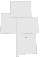
290245 - ALCALDE, New Mexico

Latitude
36° 6´N
Longitude
106° 4´W
Elevation
1731 meters

COOP Lower Rockies

New Mexico
Help

Main
10 nearest COOP Lower Rockies stations
4 miSW :CHAMITA HIGHWAY BRIDGE, NM
8 miNW :ABIQUIU, NM
8 miS :ESPANOLA, NM
9 miNE :EMBUDO, NM
14 miN :OJO CALIENTE, NM
14 miWSW :SANTA CLARA RANGER STN, NM
15 miSSE :NAMBE 1, NM
15 miESE :TRUCHAS, NM
16 miSSE :NAMBE 2, NM
17 miN :LA MADERA, NM

Weather variables    Help
Click a weather variable name to jump down to those statistics.
Total
observations
%
NDJFM
observations
%
TMAX
673
3.7%
245
3.2%
TMIN
674
3.7%
246
3.3%
PRCP
700
3.8%
288
3.8%
SNOW
706
3.9%
288
3.8%


TMAX     top of page

Data not shown:
Less than 5% of days have TMAX observations during NDJFM over 1948-1997


TMIN     top of page

Data not shown:
Less than 5% of days have TMIN observations during NDJFM over 1948-1997


PRCP (total liquid water equivalent)     top of page

Data not shown:
Less than 5% of days have PRCP observations during NDJFM over 1948-1997


SNOW     top of page

Data not shown:
Less than 5% of days have SNOW observations during NDJFM over 1948-1997