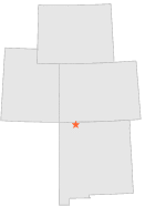
296061 - NAVAJO DAM, New Mexico

Latitude
36° 49´N
Longitude
107° 37´W
Elevation
1759 meters

COOP Lower Rockies

New Mexico
Help

Main
10 nearest COOP Lower Rockies stations
11 miSE :GOBERNADOR 7 W, NM
14 miSE :GOBERNADOR, NM
18 miNE :ARBOLES, CO
21 miW :AZTEC RUINS NATL MONUMENT, NM
22 miN :IGNACIO 1 N, CO
22 miWSW :BLOOMFIELD 3 SE, NM
32 miNNE :CHIMNEY ROCK, CO
34 miNE :STATE TURKEY EXP FAR, CO
34 miW :FARMINGTON MUNI AIRPORT, NM
35 miENE :DULCE, NM

Weather variables    Help
Click a weather variable name to jump down to those statistics.
Total
observations
%
NDJFM
observations
%
TMAX
684
3.7%
296
3.9%
TMIN
690
3.8%
302
4.0%
PRCP
713
3.9%
300
4.0%
SNOW
719
3.9%
300
4.0%


TMAX     top of page

Data not shown:
Less than 5% of days have TMAX observations during NDJFM over 1948-1997


TMIN     top of page

Data not shown:
Less than 5% of days have TMIN observations during NDJFM over 1948-1997


PRCP (total liquid water equivalent)     top of page

Data not shown:
Less than 5% of days have PRCP observations during NDJFM over 1948-1997


SNOW     top of page

Data not shown:
Less than 5% of days have SNOW observations during NDJFM over 1948-1997