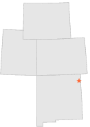
298816 - THOMAS 3 E, New Mexico

Latitude
36° 15´N
Longitude
103° 15´W
Elevation
1491 meters

COOP Lower Rockies

New Mexico
Help

Main
10 nearest COOP Lower Rockies stations
4 miSSE :SEDAN 7 NW, NM
10 miNE :CLAYTON 9 SSE, NM
14 miS :HAYDEN 6 NE, NM
15 miNNE :CLAYTON MUNICIPAL AIRPARK, NM
27 miS :AMISTAD 5 SSW, NM
27 miW :PASAMONTE, NM
31 miWSW :BUEYEROS 4 NW, NM
32 miNW :GRENVILLE, NM
35 miS :IONE, NM
38 miW :GLADSTONE, NM

Weather variables    Help
Click a weather variable name to jump down to those statistics.
Total
observations
%
NDJFM
observations
%
TMAX
0
0.0%
0
0.0%
TMIN
0
0.0%
0
0.0%
PRCP
92
0.5%
92
1.2%
SNOW
92
0.5%
92
1.2%


TMAX     top of page

Data not shown:
Less than 5% of days have TMAX observations during NDJFM over 1948-1997

No TMAX extreme events during NDJFM over 1948-1997


TMIN     top of page

Data not shown:
Less than 5% of days have TMIN observations during NDJFM over 1948-1997

No TMIN extreme events during NDJFM over 1948-1997


PRCP (total liquid water equivalent)     top of page

Data not shown:
Less than 5% of days have PRCP observations during NDJFM over 1948-1997

No days with measureable PRCP during NDJFM over 1948-1997


SNOW     top of page

Data not shown:
Less than 5% of days have SNOW observations during NDJFM over 1948-1997

No days with measureable SNOW during NDJFM over 1948-1997