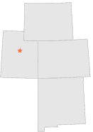
420717 - BIRDSEYE BENNIE CRK, Utah

Latitude
39° 55´N
Longitude
111° 33´W
Elevation
1665 meters

COOP Lower Rockies

Utah
Help

Main
10 nearest COOP Lower Rockies stations
2 miS :BIRDSEYE NEBO CREEK, UT
4 miSSE :BIRDSEYE, UT
4 miNNE :THISTLE 2 SW, UT
12 miNNW :SPANISH FORK PWR HOUSE, UT
12 miNW :PAYSON 1 SE, UT
13 miW :SANTAQUIN CHLORINATOR, UT
13 miNW :PAYSON, UT
14 miSSE :FAIRVIEW 8 N, UT
14 miNNW :SPANISH FORK 1 S, UT
17 miE :SOLDIER CREEK SVM, UT

Weather variables    Help
Click a weather variable name to jump down to those statistics.
Total
observations
%
NDJFM
observations
%
TMAX
31
0.2%
0
0.0%
TMIN
31
0.2%
0
0.0%
PRCP
31
0.2%
0
0.0%
SNOW
31
0.2%
0
0.0%


TMAX     top of page

Data not shown:
Less than 5% of days have TMAX observations during NDJFM over 1948-1997

No TMAX extreme events during NDJFM over 1948-1997


TMIN     top of page

Data not shown:
Less than 5% of days have TMIN observations during NDJFM over 1948-1997

No TMIN extreme events during NDJFM over 1948-1997


PRCP (total liquid water equivalent)     top of page

Data not shown:
Less than 5% of days have PRCP observations during NDJFM over 1948-1997

No days with measureable PRCP during NDJFM over 1948-1997


SNOW     top of page

Data not shown:
Less than 5% of days have SNOW observations during NDJFM over 1948-1997

No days with measureable SNOW during NDJFM over 1948-1997