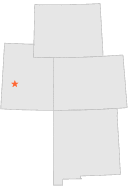
422093 - DELTA 32 SSW, Utah

Latitude
38° 56´N
Longitude
112° 49´W
Elevation
1466 meters

COOP Lower Rockies

Utah
Help

Main
10 nearest COOP Lower Rockies stations
16 miNE :CLEAR LAKE REFUGE, UT
17 miSSW :BLACK ROCK, UT
23 miESE :KANOSH, UT
26 miWSW :SEVIER DRY LAKE, UT
26 miNNE :DESERET, UT
26 miE :FILLMORE, UT
26 miSSE :COVE FORT, UT
30 miNNE :DELTA, UT
35 miNNE :DELTA FAA AP, UT
36 miSE :FREMONT INDIAN S P, UT

Weather variables    Help
Click a weather variable name to jump down to those statistics.
Total
observations
%
NDJFM
observations
%
TMAX
715
3.9%
308
4.1%
TMIN
711
3.9%
307
4.1%
PRCP
781
4.3%
299
4.0%
SNOW
609
3.3%
181
2.4%


TMAX     top of page

Data not shown:
Less than 5% of days have TMAX observations during NDJFM over 1948-1997


TMIN     top of page

Data not shown:
Less than 5% of days have TMIN observations during NDJFM over 1948-1997


PRCP (total liquid water equivalent)     top of page

Data not shown:
Less than 5% of days have PRCP observations during NDJFM over 1948-1997


SNOW     top of page

Data not shown:
Less than 5% of days have SNOW observations during NDJFM over 1948-1997