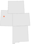
423320 - GOVERNMENT CREEK, Utah

Latitude
40° 3´N
Longitude
112° 40´W
Elevation
1610 meters

COOP Lower Rockies

Utah
Help

Main
10 nearest COOP Lower Rockies stations
8 miSW :INDIAN CREEK, UT
12 miENE :VERNON, UT
13 miE :BENMORE, UT
16 miNW :DUGWAY, UT
17 miN :DUGWAY 7 N ORR RANCH, UT
18 miNNW :DUGWAY 7 N ORR RANCH, UT
18 miNNW :ORRS RANCH, UT
20 miN :JOHNSON PASS, UT
20 miN :WILLIAMS RANCH, UT
20 miN :SEVERE RANCH, UT

Weather variables    Help
Click a weather variable name to jump down to those statistics.
Total
observations
%
NDJFM
observations
%
TMAX
491
2.7%
145
1.9%
TMIN
492
2.7%
147
1.9%
PRCP
516
2.8%
151
2.0%
SNOW
501
2.7%
146
1.9%


TMAX     top of page

Data not shown:
Less than 5% of days have TMAX observations during NDJFM over 1948-1997


TMIN     top of page

Data not shown:
Less than 5% of days have TMIN observations during NDJFM over 1948-1997


PRCP (total liquid water equivalent)     top of page

Data not shown:
Less than 5% of days have PRCP observations during NDJFM over 1948-1997


SNOW     top of page

Data not shown:
Less than 5% of days have SNOW observations during NDJFM over 1948-1997