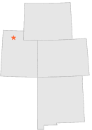
427565 - SALINE, Utah

Latitude
41° 13´N
Longitude
112° 29´W
Elevation
1290 meters

COOP Lower Rockies

Utah
Help

Main
10 nearest COOP Lower Rockies stations
2 miNNW :PROMONTORY, UT
8 miW :MIDLAKE, UT
13 miENE :BEAR RIVER BAY, UT
18 miSE :ANTELOPE ISLAND NORTH, UT
20 miW :LAKESIDE, UT
21 miNNE :BEAR RIVER REFUGE, UT
23 miE :OGDEN SUGAR FACTORY, UT
24 miE :OGDEN, UT
26 miE :RIVERDALE, UT
26 miSE :ANTELOPE ISLAND, UT

Weather variables    Help
Click a weather variable name to jump down to those statistics.
Total
observations
%
NDJFM
observations
%
TMAX
580
3.2%
92
1.2%
TMIN
580
3.2%
92
1.2%
PRCP
581
3.2%
92
1.2%
SNOW
551
3.0%
92
1.2%


TMAX     top of page

Data not shown:
Less than 5% of days have TMAX observations during NDJFM over 1948-1997


TMIN     top of page

Data not shown:
Less than 5% of days have TMIN observations during NDJFM over 1948-1997


PRCP (total liquid water equivalent)     top of page

Data not shown:
Less than 5% of days have PRCP observations during NDJFM over 1948-1997


SNOW     top of page

Data not shown:
Less than 5% of days have SNOW observations during NDJFM over 1948-1997