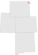
480050 - ALADDIN, Wyoming

Latitude
44° 38´N
Longitude
104° 11´W
Elevation
1141 meters

COOP Lower Rockies

Wyoming
Help

Main
10 nearest COOP Lower Rockies stations
6 miS :ALADDIN 6 S, WY
9 miSSW :BEULAH 8 WSW, WY
9 miW :ALVA 5 ESE, WY
13 miWNW :ALVA, WY
19 miSSW :SUNDANCE, WY
20 miN :COLONY, WY
21 miW :HULETT, WY
26 miW :DEVILS TOWER, WY
26 miW :DEVILS TOWER 2, WY
34 miWSW :KEYHOLE DAM, WY

Weather variables    Help
Click a weather variable name to jump down to those statistics.
Total
observations
%
NDJFM
observations
%
TMAX
0
0.0%
0
0.0%
TMIN
0
0.0%
0
0.0%
PRCP
287
1.6%
74
1.0%
SNOW
0
0.0%
0
0.0%


TMAX     top of page

Data not shown:
Less than 5% of days have TMAX observations during NDJFM over 1948-1997

No TMAX extreme events during NDJFM over 1948-1997


TMIN     top of page

Data not shown:
Less than 5% of days have TMIN observations during NDJFM over 1948-1997

No TMIN extreme events during NDJFM over 1948-1997


PRCP (total liquid water equivalent)     top of page

Data not shown:
Less than 5% of days have PRCP observations during NDJFM over 1948-1997


SNOW     top of page

Data not shown:
Less than 5% of days have SNOW observations during NDJFM over 1948-1997

No days with measureable SNOW during NDJFM over 1948-1997