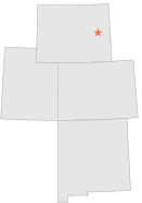
480731 - BILL 14 S, Wyoming

Latitude
43° 2´N
Longitude
105° 13´W
Elevation
-99999 meters

COOP Lower Rockies

Wyoming
Help

Main
10 nearest COOP Lower Rockies stations
6 miSSE :DOUGLAS 17 NE, WY
12 miENE :BILL 14 SE, WY
12 miSE :SHAWNEE 14 N, WY
14 miSE :SHAWNEE 10 N, WY
15 miN :BILL, WY
15 miWNW :BILL 15 SW, WY
16 miE :LANCE CREEK 12 WSW, WY
20 miNW :BILL 12 W, WY
21 miENE :LANCE CREEK 14 NW, WY
21 miSSW :DOUGLAS 1 SE, WY

Weather variables    Help
Click a weather variable name to jump down to those statistics.
Total
observations
%
NDJFM
observations
%
TMAX
0
0.0%
0
0.0%
TMIN
0
0.0%
0
0.0%
PRCP
80
0.4%
19
0.3%
SNOW
77
0.4%
16
0.2%


TMAX     top of page

Data not shown:
Less than 5% of days have TMAX observations during NDJFM over 1948-1997

No TMAX extreme events during NDJFM over 1948-1997


TMIN     top of page

Data not shown:
Less than 5% of days have TMIN observations during NDJFM over 1948-1997

No TMIN extreme events during NDJFM over 1948-1997


PRCP (total liquid water equivalent)     top of page

Data not shown:
Less than 5% of days have PRCP observations during NDJFM over 1948-1997


SNOW     top of page

Data not shown:
Less than 5% of days have SNOW observations during NDJFM over 1948-1997