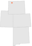
481743 - CIRCLE H RANCH, Wyoming

Latitude
44° 30´N
Longitude
109° 32´W
Elevation
1922 meters

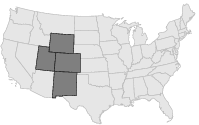
COOP Lower Rockies

Wyoming
Help

Main
10 nearest COOP Lower Rockies stations
3 miSE :WAPITI 4 W, WY
3 miWSW :WAPITI 9 W, WY
6 miESE :WAPITI 1 NE, WY
6 miSSW :WAPITI 5 WSW, WY
14 miSSE :CODY 21 SW, WY
14 miSE :BELKNAP RANCH, WY
14 miSE :ISHAWOOA, WY
17 miE :BUFFALO BILL DAM, WY
21 miS :VALLEY 3 NE, WY
23 miW :EAST GATE Y N P, WY

Weather variables    Help
Click a weather variable name to jump down to those statistics.
Total
observations
%
NDJFM
observations
%
TMAX
0
0.0%
0
0.0%
TMIN
0
0.0%
0
0.0%
PRCP
595
3.3%
241
3.2%
SNOW
0
0.0%
0
0.0%


TMAX     top of page

Data not shown:
Less than 5% of days have TMAX observations during NDJFM over 1948-1997

No TMAX extreme events during NDJFM over 1948-1997


TMIN     top of page

Data not shown:
Less than 5% of days have TMIN observations during NDJFM over 1948-1997

No TMIN extreme events during NDJFM over 1948-1997


PRCP (total liquid water equivalent)     top of page

Data not shown:
Less than 5% of days have PRCP observations during NDJFM over 1948-1997


SNOW     top of page

Data not shown:
Less than 5% of days have SNOW observations during NDJFM over 1948-1997

No days with measureable SNOW during NDJFM over 1948-1997