| Latitude 35° 53´N |
Longitude 84° 18´W |
Elevation 238 meters |
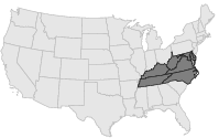
 COOP Mid-Atlantic |
 Tennessee |
Help Main |
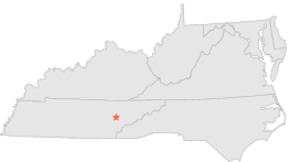
| 4 mi | NNW : | OAK RIDGE, TN |
| 6 mi | SSE : | FORT LOUDOUN DAM, TN |
| 7 mi | E : | CONCORD, TN |
| 7 mi | SSE : | LENOIR CITY, TN |
| 9 mi | NNE : | OAK RIDGE, TN |
| 11 mi | S : | LOUDON, TN |
| 12 mi | W : | KINGSTON STEAM PLANT, TN |
| 13 mi | W : | KINGSTON, TN |
| 14 mi | WNW : | HARRIMAN, TN |
| 17 mi | NNW : | PETROS, TN |