| Latitude 39° 25´N |
Longitude 79° 0´W |
Elevation 274 meters |
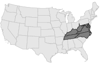
 COOP Mid-Atlantic |
 West Virginia |
Help Main |
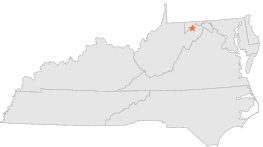
| 1 mi | NE : | KEYSER, WV |
| 3 mi | S : | KNOBLY MOUNTAIN, WV |
| 5 mi | NNW : | PIEDMONT 1 SE, WV |
| 5 mi | NW : | LUKE, MD |
| 5 mi | NNW : | WESTERNPORT, MD |
| 5 mi | NNW : | WESTERNPORT UPRC, MD |
| 10 mi | NW : | SAVAGE RIVER DAM, MD |
| 10 mi | SE : | JUNCTION, WV |
| 11 mi | WSW : | SHALLMAR, MD |
| 11 mi | WSW : | HARRISON, WV |