| Latitude 38° 28´N |
Longitude 81° 17´W |
Elevation 189 meters |
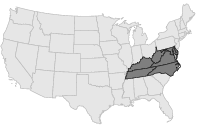
 COOP Mid-Atlantic |
 West Virginia |
Help Main |
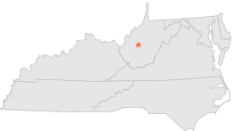
| 1 mi | NE : | CORTON, WV |
| 3 mi | WNW : | CLENDENIN, WV |
| 11 mi | E : | CLAY, WV |
| 12 mi | E : | CLAY 2, WV |
| 17 mi | SSE : | BELVA, WV |
| 17 mi | WSW : | CHARLESTON KANAWHA ARPT, WV |
| 18 mi | NNW : | SPENCER 4 S, WV |
| 18 mi | SSE : | JODIE, WV |
| 19 mi | SSW : | LONDON LOCKS, WV |
| 21 mi | WSW : | CHARLESTON 3, WV |