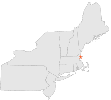
190593 - BEVERLY, Massachusetts
Latitude
42° 35´N
Longitude
70° 51´W
Elevation
24 meters
COOP Northeast
Massachusetts
Help
Main
10 nearest COOP Northeast stations
4 mi
SSW :
SALEM CG AIR STN, MA
6 mi
N :
IPSWICH, MA
6 mi
S :
MARBLEHEAD, MA
8 mi
WSW :
PEABODY, MA
8 mi
SSW :
SWAMPSCOTT, MA
9 mi
W :
MIDDLETON, MA
10 mi
SW :
WEST LYNN, MA
14 mi
ENE :
ROCKPORT 1 ESE, MA
15 mi
SW :
SPOT POND, MA
15 mi
WSW :
READING, MA
Weather variables
Help
Click a weather variable name to jump down to those statistics.
Total
observations
%
NDJFM
observations
%
TMAX
579
3.2%
212
2.8%
TMIN
579
3.2%
212
2.8%
PRCP
579
3.2%
212
2.8%
SNOW
578
3.2%
211
2.8%
TMAX
top of page
Data not shown:
Less than 5% of days have TMAX observations during NDJFM over 1948-1997
TMIN
top of page
Data not shown:
Less than 5% of days have TMIN observations during NDJFM over 1948-1997
PRCP
(total liquid water equivalent)
top of page
Data not shown:
Less than 5% of days have PRCP observations during NDJFM over 1948-1997
SNOW
top of page
Data not shown:
Less than 5% of days have SNOW observations during NDJFM over 1948-1997