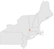
194131 - LENOX DALE, Massachusetts
Latitude
42° 20´N
Longitude
73° 15´W
Elevation
312 meters
COOP Northeast
Massachusetts
Help
Main
10 nearest COOP Northeast stations
5 mi
WSW :
STOCKBRIDGE, MA
6 mi
ENE :
WASHINGTON 2, MA
6 mi
ENE :
WASHINGTON, MA
7 mi
E :
BECKET 2 SW, MA
7 mi
NNW :
PITTSFIELD, MA
8 mi
N :
PITTSFIELD, MA
10 mi
NW :
CANAAN 2 E, NY
10 mi
S :
WEST OTIS, MA
11 mi
NNE :
DALTON, MA
11 mi
ENE :
PERU, MA
Weather variables
Help
Click a weather variable name to jump down to those statistics.
Total
observations
%
NDJFM
observations
%
TMAX
408
2.2%
181
2.4%
TMIN
408
2.2%
181
2.4%
PRCP
410
2.2%
173
2.3%
SNOW
426
2.3%
180
2.4%
TMAX
top of page
Data not shown:
Less than 5% of days have TMAX observations during NDJFM over 1948-1997
TMIN
top of page
Data not shown:
Less than 5% of days have TMIN observations during NDJFM over 1948-1997
PRCP
(total liquid water equivalent)
top of page
Data not shown:
Less than 5% of days have PRCP observations during NDJFM over 1948-1997
SNOW
top of page
Data not shown:
Less than 5% of days have SNOW observations during NDJFM over 1948-1997