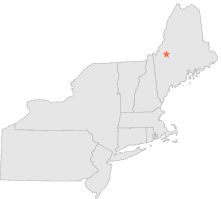
171870 - DEAD RIVER 26 N, Maine

Latitude
45° 14´N
Longitude
70° 12´W
Elevation
354 meters

COOP Northeast

Maine
Help

Main
10 nearest COOP Northeast stations
1 miS :LONG FALLS DAM, ME
14 miNE :WEST FORKS, ME
14 miW :EUSTIS, ME
14 miW :EUSTIS 2, ME
14 miNE :THE FORKS, ME
14 miWSW :STRATTON, ME
15 miW :EUSTIS 2 SSE, ME
18 miS :KINGFIELD, ME
19 miSE :BINGHAM WYMAN DAM, ME
23 miNE :HARRIS STATION, ME

Weather variables    Help
Click a weather variable name to jump down to those statistics.
Total
observations
%
NDJFM
observations
%
TMAX
332
1.8%
152
2.0%
TMIN
335
1.8%
151
2.0%
PRCP
580
3.2%
244
3.2%
SNOW
580
3.2%
244
3.2%


TMAX     top of page

Data not shown:
Less than 5% of days have TMAX observations during NDJFM over 1948-1997


TMIN     top of page

Data not shown:
Less than 5% of days have TMIN observations during NDJFM over 1948-1997


PRCP (total liquid water equivalent)     top of page

Data not shown:
Less than 5% of days have PRCP observations during NDJFM over 1948-1997


SNOW     top of page

Data not shown:
Less than 5% of days have SNOW observations during NDJFM over 1948-1997