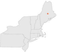
175347 - MILO, Maine

Latitude
45° 15´N
Longitude
69° 1´W
Elevation
128 meters

COOP Northeast

Maine
Help

Main
10 nearest COOP Northeast stations
7 miWNW :BARNARD, ME
9 miWSW :EAST DOVER, ME
11 miW :SEBEC LAKE, ME
12 miWSW :DOVER-FOXCROFT, ME
15 miWSW :EAST SANGERVILLE 5 SE, ME
18 miE :WEST ENFIELD, ME
19 miWSW :GUILFORD, ME
26 miSSW :CORINNA, ME
27 miSE :OLD TOWN FAA AIRPORT, ME
28 miW :BLANCHARD, ME

Weather variables    Help
Click a weather variable name to jump down to those statistics.
Total
observations
%
NDJFM
observations
%
TMAX
62
0.3%
62
0.8%
TMIN
62
0.3%
62
0.8%
PRCP
457
2.5%
151
2.0%
SNOW
456
2.5%
151
2.0%


TMAX     top of page

Data not shown:
Less than 5% of days have TMAX observations during NDJFM over 1948-1997


TMIN     top of page

Data not shown:
Less than 5% of days have TMIN observations during NDJFM over 1948-1997


PRCP (total liquid water equivalent)     top of page

Data not shown:
Less than 5% of days have PRCP observations during NDJFM over 1948-1997


SNOW     top of page

Data not shown:
Less than 5% of days have SNOW observations during NDJFM over 1948-1997