| Latitude 45° 34´N |
Longitude 67° 26´W |
Elevation 140 meters |
 COOP Northeast |
 Maine |
Help Main |

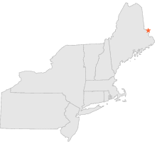
| 0 mi | N : | VANCEBORO 2, ME |
| 22 mi | WNW : | DANFORTH, ME |
| 29 mi | S : | WOODLAND, ME |
| 31 mi | SSW : | GRAND LAKE STREAM, ME |
| 34 mi | NW : | HAYNESVILLE, ME |
| 36 mi | WSW : | PRENTISS, ME |
| 37 mi | SSE : | ROBBINSTON, ME |
| 37 mi | WSW : | SPRINGFIELD, ME |
| 43 mi | NNW : | HOULTON INTL AIRPORT, ME |
| 44 mi | NNW : | HOULTON, ME |