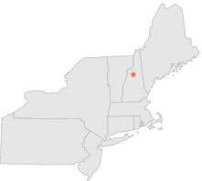
271590 - CLEAR BROOK, New Hampshire

Latitude
44° 4´N
Longitude
71° 38´W
Elevation
488 meters

COOP Northeast

New Hampshire
Help

Main
10 nearest COOP Northeast stations
2 miSW :LINCOLN, NH
6 miSSW :WOODSTOCK, NH
8 miNNW :CANNON MOUNTAIN, NH
10 miSE :WATERVILLE V ALLEY, NH
13 miW :BENTON, NH
13 miNNW :FRANCONIA, NH
14 miWNW :LANDAFF, NH
14 miWSW :GLENCLIFF, NH
14 miWSW :GLENCLIFF 2, NH
15 miS :CAMPTON, NH

Weather variables    Help
Click a weather variable name to jump down to those statistics.
Total
observations
%
NDJFM
observations
%
TMAX
0
0.0%
0
0.0%
TMIN
0
0.0%
0
0.0%
PRCP
515
2.8%
149
2.0%
SNOW
152
0.8%
0
0.0%


TMAX     top of page

Data not shown:
Less than 5% of days have TMAX observations during NDJFM over 1948-1997

No TMAX extreme events during NDJFM over 1948-1997


TMIN     top of page

Data not shown:
Less than 5% of days have TMIN observations during NDJFM over 1948-1997

No TMIN extreme events during NDJFM over 1948-1997


PRCP (total liquid water equivalent)     top of page

Data not shown:
Less than 5% of days have PRCP observations during NDJFM over 1948-1997


SNOW     top of page

Data not shown:
Less than 5% of days have SNOW observations during NDJFM over 1948-1997

No days with measureable SNOW during NDJFM over 1948-1997