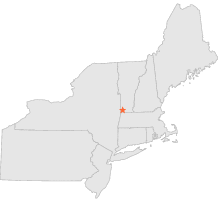
430558 - BENNINGTON, Vermont

Latitude
42° 51´N
Longitude
73° 10´W
Elevation
268 meters

COOP Northeast

Vermont
Help

Main
10 nearest COOP Northeast stations
5 miNNW :BENNINGTON 2 NNW, VT
5 miSSW :POWNAL 1 NE, VT
7 miENE :WOODFORD, VT
9 miENE :SEARSBURG POWER PLANT, VT
11 miSW :PETERSBURG 2 SE, NY
12 miWNW :EAGLE BRIDGE 2 SE, NY
12 miSW :BERLIN 4 ENE, NY
13 miE :SEARSBURG STATION, VT
13 miS :NORTH ADAMS, MA
13 miESE :WHITINGHAM 1 W, VT

Weather variables    Help
Click a weather variable name to jump down to those statistics.
Total
observations
%
NDJFM
observations
%
TMAX
840
4.6%
302
4.0%
TMIN
848
4.6%
302
4.0%
PRCP
847
4.6%
299
4.0%
SNOW
847
4.6%
299
4.0%


TMAX     top of page

Data not shown:
Less than 5% of days have TMAX observations during NDJFM over 1948-1997


TMIN     top of page

Data not shown:
Less than 5% of days have TMIN observations during NDJFM over 1948-1997


PRCP (total liquid water equivalent)     top of page

Data not shown:
Less than 5% of days have PRCP observations during NDJFM over 1948-1997


SNOW     top of page

Data not shown:
Less than 5% of days have SNOW observations during NDJFM over 1948-1997