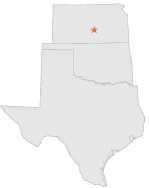
143921 - HUTCHINSON RIVER, Kansas

Latitude
38° 2´N
Longitude
97° 56´W
Elevation
462 meters

COOP South Central

Kansas
Help

Main
10 nearest COOP South Central stations
4 miENE :HUTCHINSON MUNICIPAL AP, KS
5 miNNE :HUTCHINSON 4 NE, KS
9 miSW :HUTCHINSON 10 SW, KS
11 miNW :NICKERSON, KS
15 miE :BURRTON, KS
17 miNNE :INMAN, KS
19 miSE :MOUNT HOPE, KS
19 miNW :STERLING, KS
20 miWSW :PLEVNA, KS
23 miNW :LYONS 3 S, KS

Weather variables    Help
Click a weather variable name to jump down to those statistics.
Total
observations
%
NDJFM
observations
%
TMAX
456
2.5%
242
3.2%
TMIN
455
2.5%
241
3.2%
PRCP
456
2.5%
242
3.2%
SNOW
456
2.5%
242
3.2%


TMAX     top of page

Data not shown:
Less than 5% of days have TMAX observations during NDJFM over 1948-1997


TMIN     top of page

Data not shown:
Less than 5% of days have TMIN observations during NDJFM over 1948-1997


PRCP (total liquid water equivalent)     top of page

Data not shown:
Less than 5% of days have PRCP observations during NDJFM over 1948-1997


SNOW     top of page

Data not shown:
Less than 5% of days have SNOW observations during NDJFM over 1948-1997