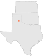
411761_23072 - CLARENDON MUNICIPAL AP, Texas
Latitude
34° 57´N
Longitude
100° 56´W
Elevation
875 meters
COOP South Central
Texas
Help
Main
10 nearest COOP South Central stations
3 mi
ESE :
CLARENDON, TX
19 mi
S :
BRICE 2 S, TX
27 mi
WNW :
CLAUDE, TX
27 mi
NE :
MC LEAN, TX
27 mi
ESE :
MEMPHIS, TX
34 mi
S :
TAMPICO, TX
36 mi
WSW :
WAYSIDE, TX
38 mi
S :
TURKEY, TX
39 mi
SSW :
SILVERTON, TX
40 mi
N :
PAMPA, TX
Weather variables
Help
Click a weather variable name to jump down to those statistics.
Total
observations
%
NDJFM
observations
%
TMAX
829
4.5%
337
4.5%
TMIN
828
4.5%
336
4.4%
PRCP
828
4.5%
337
4.5%
SNOW
828
4.5%
336
4.4%
TMAX
top of page
Data not shown:
Less than 5% of days have TMAX observations during NDJFM over 1948-1997
TMIN
top of page
Data not shown:
Less than 5% of days have TMIN observations during NDJFM over 1948-1997
PRCP
(total liquid water equivalent)
top of page
Data not shown:
Less than 5% of days have PRCP observations during NDJFM over 1948-1997
SNOW
top of page
Data not shown:
Less than 5% of days have SNOW observations during NDJFM over 1948-1997