| Latitude 33° 49´N |
Longitude 96° 32´W |
Elevation 168 meters |
 COOP South Central |
 Texas |
Help Main |

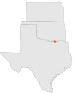
| 2 mi | W : | DENISON DAM, TX |
| 10 mi | SW : | SHERMAN, TX |
| 16 mi | WNW : | WILLIS OK UNIV BIO STN, OK |
| 16 mi | NNE : | DURANT, OK |
| 17 mi | NW : | KINGSTON, OK |
| 17 mi | E : | YUBA 2 W, OK |
| 18 mi | W : | GORDONVILLE, TX |
| 19 mi | N : | CUMBERLAND OIL FIELD, OK |
| 25 mi | ESE : | BONHAM 3 NNE, TX |
| 25 mi | NW : | MADILL, OK |