| Latitude 30° 1´N |
Longitude 100° 13´W |
Elevation 735 meters |
 COOP South Central |
 Texas |
Help Main |

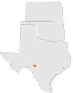
| 0 mi | N : | ROCKSPRINGS, TX |
| 5 mi | W : | ROCKSPRINGS 5 W, TX |
| 11 mi | WNW : | ALLISON RANCH, TX |
| 14 mi | NE : | ROCKSPRINGS 14 NE, TX |
| 15 mi | NW : | CLOUDT RANCH, TX |
| 17 mi | ENE : | MENZIES BILL RANCH, TX |
| 20 mi | SW : | ROCKSPRINGS 18 SW, TX |
| 25 mi | NNW : | HUMBLE PUMP STN 5 WNW, TX |
| 26 mi | SSE : | CAMP WOOD, TX |
| 26 mi | SSW : | ROCKSPRINGS 26 SSW, TX |