and their frequency under extreme phases of the PNA
| COOP Southwest main | PRCP | PRCP tables | Station maps and lists |
Days on which the PRCP amount was in the top 20% of the 1948-1997 NDJFM days with measureable recorded PRCP
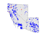 |
View maps like example to left of relative occurrences of high PRCP during extreme positive and negatve phases of PNA |
| See also PRCP and: | NAM | CTI |
| See also PNA and: | TMAX | TMIN | SNOW |
Days on which measureable PRCP was recorded
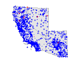 |
View maps like example to left of relative PRCP occurrences during extreme positive and negatve phases of PNA |
| See also PRCP and: | NAM | CTI |
| See also PNA and: | TMAX | TMIN | SNOW |
Daily precipitation (total liquid water equivalent)
More on PRCP
the Pacific-North America pattern index
More on the PNA