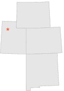
422073 - DELLE, Utah

Latitude
40° 46´N
Longitude
112° 48´W
Elevation
1302 meters

COOP Lower Rockies

Utah
Help

Main
10 nearest COOP Lower Rockies stations
8 miE :TIMPIE, UT
9 miSE :CALLISTER RANCH, UT
10 miENE :ROWLEY PUMP STN, UT
10 miENE :ROWLEY CANAL STATION, UT
19 miS :IOSEPA SOUTH RANCH, UT
20 miW :KNOLLS AP, UT
21 miNNW :UTAH TEST RANGE, UT
21 miESE :GRANTSVILLE, UT
21 miW :KNOLLS 10 NE, UT
23 miSE :GRANTSVILLE POWERHOUSE, UT

Weather variables    Help
Click a weather variable name to jump down to those statistics.
Total
observations
%
NDJFM
observations
%
TMAX
450
2.5%
148
2.0%
TMIN
450
2.5%
149
2.0%
PRCP
471
2.6%
153
2.0%
SNOW
471
2.6%
153
2.0%


TMAX     top of page

Data not shown:
Less than 5% of days have TMAX observations during NDJFM over 1948-1997


TMIN     top of page

Data not shown:
Less than 5% of days have TMIN observations during NDJFM over 1948-1997


PRCP (total liquid water equivalent)     top of page

Data not shown:
Less than 5% of days have PRCP observations during NDJFM over 1948-1997


SNOW     top of page

Data not shown:
Less than 5% of days have SNOW observations during NDJFM over 1948-1997