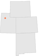
428741 - TIMPIE, Utah

Latitude
40° 45´N
Longitude
112° 39´W
Elevation
1293 meters

COOP Lower Rockies

Utah
Help

Main
10 nearest COOP Lower Rockies stations
4 miNNE :ROWLEY PUMP STN, UT
4 miNNE :ROWLEY CANAL STATION, UT
5 miS :CALLISTER RANCH, UT
8 miW :DELLE, UT
14 miSE :GRANTSVILLE, UT
18 miSSE :GRANTSVILLE POWERHOUSE, UT
18 miSSW :IOSEPA SOUTH RANCH, UT
24 miE :GARFIELD, UT
24 miSE :TOOELE, UT
24 miESE :COON PEAK KSL TV, UT

Weather variables    Help
Click a weather variable name to jump down to those statistics.
Total
observations
%
NDJFM
observations
%
TMAX
135
0.7%
16
0.2%
TMIN
143
0.8%
24
0.3%
PRCP
152
0.8%
30
0.4%
SNOW
152
0.8%
30
0.4%


TMAX     top of page

Data not shown:
Less than 5% of days have TMAX observations during NDJFM over 1948-1997


TMIN     top of page

Data not shown:
Less than 5% of days have TMIN observations during NDJFM over 1948-1997


PRCP (total liquid water equivalent)     top of page

Data not shown:
Less than 5% of days have PRCP observations during NDJFM over 1948-1997


SNOW     top of page

Data not shown:
Less than 5% of days have SNOW observations during NDJFM over 1948-1997

No days with measureable SNOW during NDJFM over 1948-1997