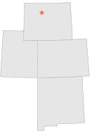
489782 - WORLAND 21 W, Wyoming

Latitude
44° 0´N
Longitude
108° 24´W
Elevation
-99999 meters

COOP Lower Rockies

Wyoming
Help

Main
10 nearest COOP Lower Rockies stations
4 miE :WORLAND 18 W, WY
10 miWNW :GOOSEBERRY CREEK, WY
13 miWSW :GRASS CREEK, WY
17 miSSW :HAMILTON DOME, WY
19 miE :WORLAND 5 SW, WY
21 miSSW :ARAPAHOE RANCH, WY
22 miE :WORLAND, WY
22 miE :WORLAND MUNICIPAL AP, WY
22 miSE :THERMOPOLIS 9 NE, WY
22 miSSW :THERMOPOLIS 22 WNW, WY

Weather variables    Help
Click a weather variable name to jump down to those statistics.
Total
observations
%
NDJFM
observations
%
TMAX
0
0.0%
0
0.0%
TMIN
0
0.0%
0
0.0%
PRCP
400
2.2%
144
1.9%
SNOW
0
0.0%
0
0.0%


TMAX     top of page

Data not shown:
Less than 5% of days have TMAX observations during NDJFM over 1948-1997

No TMAX extreme events during NDJFM over 1948-1997


TMIN     top of page

Data not shown:
Less than 5% of days have TMIN observations during NDJFM over 1948-1997

No TMIN extreme events during NDJFM over 1948-1997


PRCP (total liquid water equivalent)     top of page

Data not shown:
Less than 5% of days have PRCP observations during NDJFM over 1948-1997


SNOW     top of page

Data not shown:
Less than 5% of days have SNOW observations during NDJFM over 1948-1997

No days with measureable SNOW during NDJFM over 1948-1997