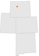
488886 - THERMOPOLIS 22 WNW, Wyoming

Latitude
43° 43´N
Longitude
108° 37´W
Elevation
1629 meters

COOP Lower Rockies

Wyoming
Help

Main
10 nearest COOP Lower Rockies stations
4 miE :ARAPAHOE RANCH, WY
4 miW :THERMOPOLIS 25 WNW, WY
6 miNE :HAMILTON DOME, WY
7 miW :THERMOPOLIS 27 WNW, WY
11 miWSW :ANCHOR DAM, WY
15 miSW :MAIL CAMP, WY
16 miN :GRASS CREEK, WY
20 miESE :THERMOPOLIS 2, WY
21 miESE :THERMOPOLIS, WY
22 miN :GOOSEBERRY CREEK, WY

Weather variables    Help
Click a weather variable name to jump down to those statistics.
Total
observations
%
NDJFM
observations
%
TMAX
0
0.0%
0
0.0%
TMIN
0
0.0%
0
0.0%
PRCP
577
3.2%
193
2.6%
SNOW
571
3.1%
187
2.5%


TMAX     top of page

Data not shown:
Less than 5% of days have TMAX observations during NDJFM over 1948-1997

No TMAX extreme events during NDJFM over 1948-1997


TMIN     top of page

Data not shown:
Less than 5% of days have TMIN observations during NDJFM over 1948-1997

No TMIN extreme events during NDJFM over 1948-1997


PRCP (total liquid water equivalent)     top of page

Data not shown:
Less than 5% of days have PRCP observations during NDJFM over 1948-1997


SNOW     top of page

Data not shown:
Less than 5% of days have SNOW observations during NDJFM over 1948-1997