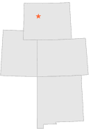
485878 - MAIL CAMP, Wyoming

Latitude
43° 35´N
Longitude
108° 51´W
Elevation
1970 meters

COOP Lower Rockies

Wyoming
Help

Main
10 nearest COOP Lower Rockies stations
6 miN :ANCHOR DAM, WY
10 miNNE :THERMOPOLIS 27 WNW, WY
12 miWSW :MORTON 28 NW, WY
12 miNE :THERMOPOLIS 25 WNW, WY
15 miNE :THERMOPOLIS 22 WNW, WY
18 miSE :PAVILLION 9 NE, WY
18 miENE :ARAPAHOE RANCH, WY
20 miNE :HAMILTON DOME, WY
24 miSW :CROWHEART 2 E, WY
24 miSSE :PAVILLION, WY

Weather variables    Help
Click a weather variable name to jump down to those statistics.
Total
observations
%
NDJFM
observations
%
TMAX
0
0.0%
0
0.0%
TMIN
0
0.0%
0
0.0%
PRCP
879
4.8%
355
4.7%
SNOW
0
0.0%
0
0.0%


TMAX     top of page

Data not shown:
Less than 5% of days have TMAX observations during NDJFM over 1948-1997

No TMAX extreme events during NDJFM over 1948-1997


TMIN     top of page

Data not shown:
Less than 5% of days have TMIN observations during NDJFM over 1948-1997

No TMIN extreme events during NDJFM over 1948-1997


PRCP (total liquid water equivalent)     top of page

Data not shown:
Less than 5% of days have PRCP observations during NDJFM over 1948-1997


SNOW     top of page

Data not shown:
Less than 5% of days have SNOW observations during NDJFM over 1948-1997

No days with measureable SNOW during NDJFM over 1948-1997