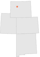
488889 - THERMOPOLIS 27 WNW, Wyoming

Latitude
43° 43´N
Longitude
108° 45´W
Elevation
1796 meters

COOP Lower Rockies

Wyoming
Help

Main
10 nearest COOP Lower Rockies stations
2 miE :THERMOPOLIS 25 WNW, WY
5 miSW :ANCHOR DAM, WY
7 miE :THERMOPOLIS 22 WNW, WY
10 miSSW :MAIL CAMP, WY
11 miE :ARAPAHOE RANCH, WY
11 miENE :HAMILTON DOME, WY
17 miNNE :GRASS CREEK, WY
21 miSW :MORTON 28 NW, WY
23 miNNE :GOOSEBERRY CREEK, WY
24 miSSE :PAVILLION 9 NE, WY

Weather variables    Help
Click a weather variable name to jump down to those statistics.
Total
observations
%
NDJFM
observations
%
TMAX
0
0.0%
0
0.0%
TMIN
0
0.0%
0
0.0%
PRCP
588
3.2%
302
4.0%
SNOW
1
0.0%
0
0.0%


TMAX     top of page

Data not shown:
Less than 5% of days have TMAX observations during NDJFM over 1948-1997

No TMAX extreme events during NDJFM over 1948-1997


TMIN     top of page

Data not shown:
Less than 5% of days have TMIN observations during NDJFM over 1948-1997

No TMIN extreme events during NDJFM over 1948-1997


PRCP (total liquid water equivalent)     top of page

Data not shown:
Less than 5% of days have PRCP observations during NDJFM over 1948-1997


SNOW     top of page

Data not shown:
Less than 5% of days have SNOW observations during NDJFM over 1948-1997

No days with measureable SNOW during NDJFM over 1948-1997