154138 - INEZ 2 E, Kentucky

Latitude
37° 52´N
Longitude
82° 31´W
Elevation
216 meters
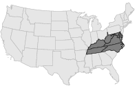
COOP Mid-Atlantic

Kentucky
Help

Main
10 nearest COOP Mid-Atlantic stations
1 miW :INEZ, KY
5 miW :TOMAHAWK 1 WSW, KY
7 miESE :KERMIT, WV
7 miSW :DAVELLA, KY
9 miNE :DUNLOW 1 SW, WV
9 miSSE :LAURA, KY
12 miNE :CABWAYLINGO STATE FOREST, WV
13 miNE :DUNLOW 5 SE, WV
15 miWSW :PAINTSVILLE 1 E, KY

Weather variables    Help
Click a weather variable name to jump down to those statistics.
Total
observations
%
NDJFM
observations
%
TMAX
31
0.2%
0
0.0%
TMIN
31
0.2%
0
0.0%
PRCP
31
0.2%
0
0.0%
SNOW
31
0.2%
0
0.0%


TMAX     top of page

Data not shown:
Less than 5% of days have TMAX observations during NDJFM over 1948-1997

No TMAX extreme events during NDJFM over 1948-1997


TMIN     top of page

Data not shown:
Less than 5% of days have TMIN observations during NDJFM over 1948-1997

No TMIN extreme events during NDJFM over 1948-1997


PRCP (total liquid water equivalent)     top of page

Data not shown:
Less than 5% of days have PRCP observations during NDJFM over 1948-1997

No days with measureable PRCP during NDJFM over 1948-1997


SNOW     top of page

Data not shown:
Less than 5% of days have SNOW observations during NDJFM over 1948-1997

No days with measureable SNOW during NDJFM over 1948-1997