| Latitude 37° 52´N |
Longitude 82° 37´W |
Elevation 210 meters |
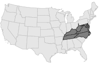
 COOP Mid-Atlantic |
 Kentucky |
Help Main |
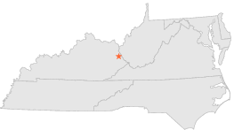
| 0 mi | N : | TOMAHAWK 1 WSW, KY |
| 5 mi | E : | INEZ, KY |
| 5 mi | E : | INEZ 2 E, KY |
| 6 mi | S : | DAVELLA, KY |
| 10 mi | WSW : | PAINTSVILLE 1 E, KY |
| 11 mi | SW : | DEWEY DAM, KY |
| 12 mi | E : | KERMIT, WV |
| 13 mi | SE : | LAURA, KY |
| 13 mi | ENE : | DUNLOW 1 SW, WV |
| 16 mi | NW : | BLAINE, KY |