| Latitude 39° 51´N |
Longitude 86° 7´W |
Elevation 226 meters |
 COOP Midwest |
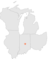
 Indiana |
Help Main |
| 4 mi | NW : | INDIANAPOLIS HOL PARK, IN |
| 6 mi | SSW : | INDIANAPOLIS WB CITY, IN |
| 6 mi | SSW : | INDIANAPOLIS W 10 ST, IN |
| 7 mi | SSW : | INDIANAPOLIS ZOO, IN |
| 8 mi | NNE : | FISHERS 2 N, IN |
| 8 mi | ENE : | OAKLANDON GEIST RESERVOIR, IN |
| 9 mi | NNE : | LYNNWOOD FARMS, IN |
| 10 mi | SSE : | INDIANAPOLIS SE SIDE, IN |
| 10 mi | W : | INDIANAPOLIS EAGLE CREEK, IN |
| 12 mi | SW : | INDIANAPOLIS INT'L ARPT, IN |