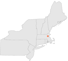
190166 - ARLINGTON, Massachusetts
Latitude
42° 25´N
Longitude
71° 11´W
Elevation
55 meters
COOP Northeast
Massachusetts
Help
Main
10 nearest COOP Northeast stations
2 mi
NNW :
LEXINGTON, MA
4 mi
SE :
CAMBRIDGE, MA
6 mi
ENE :
SPOT POND, MA
6 mi
SSE :
CHESTNUT HILL, MA
7 mi
NW :
BEDFORD, MA
7 mi
WSW :
WESTON, MA
7 mi
NNE :
READING, MA
8 mi
SSW :
NEWTON, MA
9 mi
ESE :
BOSTON LOGAN INT'L ARPT, MA
10 mi
WNW :
CONCORD, MA
Weather variables
Help
Click a weather variable name to jump down to those statistics.
Total
observations
%
NDJFM
observations
%
TMAX
610
3.3%
243
3.2%
TMIN
610
3.3%
243
3.2%
PRCP
610
3.3%
243
3.2%
SNOW
610
3.3%
243
3.2%
TMAX
top of page
Data not shown:
Less than 5% of days have TMAX observations during NDJFM over 1948-1997
TMIN
top of page
Data not shown:
Less than 5% of days have TMIN observations during NDJFM over 1948-1997
PRCP
(total liquid water equivalent)
top of page
Data not shown:
Less than 5% of days have PRCP observations during NDJFM over 1948-1997
SNOW
top of page
Data not shown:
Less than 5% of days have SNOW observations during NDJFM over 1948-1997