| Latitude 32° 8´N |
Longitude 88° 2´W |
Elevation 6 meters |
 COOP Southeast |
 Alabama |
Help Main |
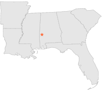
| 0 mi | N : | PENNINGTON LOCK 2, AL |
| 7 mi | N : | PENNINGTON 2 NE, AL |
| 10 mi | N : | WHITFIELD LOCK 3, AL |
| 10 mi | N : | WHITFIELD LOCK 3, AL |
| 12 mi | WSW : | BUTLER, AL |
| 15 mi | S : | CAMPBELL, AL |
| 19 mi | WNW : | PUSHMATAHA, AL |
| 22 mi | E : | MAGNOLIA, AL |
| 25 mi | SW : | GILBERTOWN, AL |
| 27 mi | SSW : | COFFEEVILLE L & D, AL |