| Latitude 30° 33´N |
Longitude 92° 5´W |
Elevation 21 meters |
 COOP Southeast |
 Louisiana |
Help Main |
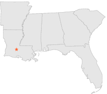
| 3 mi | S : | OPELOUSAS, LA |
| 9 mi | SSE : | GRAND COTEAU, LA |
| 14 mi | NW : | VILLE PLATTE, LA |
| 16 mi | S : | CARENCRO, LA |
| 19 mi | SW : | RAYNE 6 N, LA |
| 20 mi | E : | KROTZ SPRINGS, LA |
| 21 mi | W : | MAMOU 4 S, LA |
| 21 mi | WSW : | EUNICE, LA |
| 23 mi | SE : | HENDERSON 2 W, LA |
| 23 mi | ENE : | MELVILLE, LA |