| Latitude 39° 9´N |
Longitude 79° 30´W |
Elevation 917 meters |
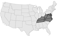
 COOP Mid-Atlantic |
 West Virginia |
Help Main |
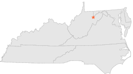
| 2 mi | ESE : | DAVIS, WV |
| 7 mi | SSE : | CANNAAN VALLEY 2, WV |
| 8 mi | SSE : | CANAAN VALLEY, WV |
| 10 mi | WSW : | PARSONS 1 NE, WV |
| 10 mi | WSW : | PARSONS 2, WV |
| 11 mi | NE : | BAYARD, WV |
| 11 mi | E : | STONY RIVER DAM, WV |
| 12 mi | E : | STONY RIVER DAM 2, WV |
| 16 mi | NW : | ROWLESBURG 1, WV |
| 16 mi | NNW : | ROWLESBURG 2, WV |