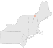
271662 - COLUMBIA, New Hampshire

Latitude
44° 47´N
Longitude
71° 34´W
Elevation
299 meters

COOP Northeast

New Hampshire
Help

Main
10 nearest COOP Northeast stations
1 miW :BLOOMFIELD, VT
2 miSW :LYMAN FALLS, VT
4 miSW :NORTH STRATFORD, NH
8 miNNE :LEMINGTON, VT
9 miNNE :COLEBROOK, NH
13 miENE :DIXVILLE NOTCH, NH
14 miN :CANAAN, VT
15 miW :ISLAND POND, VT
15 miN :WEST STEWARTSTOWN, NH
17 miNE :DIAMOND POND, NH

Weather variables    Help
Click a weather variable name to jump down to those statistics.
Total
observations
%
NDJFM
observations
%
TMAX
92
0.5%
61
0.8%
TMIN
92
0.5%
61
0.8%
PRCP
92
0.5%
61
0.8%
SNOW
90
0.5%
59
0.8%


TMAX     top of page

Data not shown:
Less than 5% of days have TMAX observations during NDJFM over 1948-1997


TMIN     top of page

Data not shown:
Less than 5% of days have TMIN observations during NDJFM over 1948-1997


PRCP (total liquid water equivalent)     top of page

Data not shown:
Less than 5% of days have PRCP observations during NDJFM over 1948-1997


SNOW     top of page

Data not shown:
Less than 5% of days have SNOW observations during NDJFM over 1948-1997