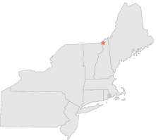
279525 - WEST STEWARTSTOWN, New Hampshire

Latitude
45° 0´N
Longitude
71° 32´W
Elevation
329 meters

COOP Northeast

New Hampshire
Help

Main
10 nearest COOP Northeast stations
1 miSW :CANAAN, VT
7 miS :LEMINGTON, VT
7 miSSE :COLEBROOK, NH
8 miENE :PITTSBURG RESERVOIR, NH
11 miESE :DIAMOND POND, NH
13 miSE :DIXVILLE NOTCH, NH
13 miENE :FIRST CONN LAKE, NH
15 miS :COLUMBIA, NH
15 miS :BLOOMFIELD, VT
16 miSSW :LYMAN FALLS, VT

Weather variables    Help
Click a weather variable name to jump down to those statistics.
Total
observations
%
NDJFM
observations
%
TMAX
0
0.0%
0
0.0%
TMIN
0
0.0%
0
0.0%
PRCP
778
4.3%
302
4.0%
SNOW
769
4.2%
280
3.7%


TMAX     top of page

Data not shown:
Less than 5% of days have TMAX observations during NDJFM over 1948-1997

No TMAX extreme events during NDJFM over 1948-1997


TMIN     top of page

Data not shown:
Less than 5% of days have TMIN observations during NDJFM over 1948-1997

No TMIN extreme events during NDJFM over 1948-1997


PRCP (total liquid water equivalent)     top of page

Data not shown:
Less than 5% of days have PRCP observations during NDJFM over 1948-1997


SNOW     top of page

Data not shown:
Less than 5% of days have SNOW observations during NDJFM over 1948-1997