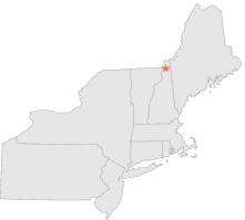
271968 - DIAMOND POND, New Hampshire

Latitude
44° 57´N
Longitude
71° 19´W
Elevation
671 meters

COOP Northeast

New Hampshire
Help

Main
10 nearest COOP Northeast stations
6 miS :DIXVILLE NOTCH, NH
8 miNNW :PITTSBURG RESERVOIR, NH
9 miWSW :COLEBROOK, NH
9 miN :FIRST CONN LAKE, NH
10 miWSW :LEMINGTON, VT
11 miWNW :WEST STEWARTSTOWN, NH
12 miWNW :CANAAN, VT
15 miSE :ERROL, NH
17 miSW :COLUMBIA, NH
17 miSW :BLOOMFIELD, VT

Weather variables    Help
Click a weather variable name to jump down to those statistics.
Total
observations
%
NDJFM
observations
%
TMAX
30
0.2%
30
0.4%
TMIN
31
0.2%
31
0.4%
PRCP
29
0.2%
29
0.4%
SNOW
29
0.2%
29
0.4%


TMAX     top of page

Data not shown:
Less than 5% of days have TMAX observations during NDJFM over 1948-1997


TMIN     top of page

Data not shown:
Less than 5% of days have TMIN observations during NDJFM over 1948-1997


PRCP (total liquid water equivalent)     top of page

Data not shown:
Less than 5% of days have PRCP observations during NDJFM over 1948-1997


SNOW     top of page

Data not shown:
Less than 5% of days have SNOW observations during NDJFM over 1948-1997