| Latitude 38° 26´N |
Longitude 117° 12´W |
Elevation 1867 meters |
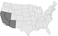
 COOP Southwest |
 Nevada |
Help Main |
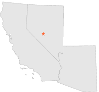
| 6 mi | NE : | MANHATTAN POWER HOUSE, NV |
| 15 mi | N : | SMOKEY VALLEY, NV |
| 15 mi | S : | TONOPAH, NV |
| 16 mi | SSE : | TONOPAH AIRPORT, NV |
| 22 mi | NW : | BERLIN STATE PARK, NV |
| 28 mi | SW : | COALDALE, NV |
| 29 mi | NW : | GABBS, NV |
| 43 mi | ESE : | STONE CABIN VALLEY, NV |
| 51 mi | W : | MINA, NV |
| 54 mi | E : | BLUE JAY HIGHWAY STN, NV |