
Climatological Rainfall & Surface Temperature
This page presents climatologies for the globe, selected regions, Washington State, and the Seattle metropolitan area as a resource to students and researchers. Information presented ranges from digital values and maps for selected regions to animations to interactive java plotting and data access routines.
Analyses of the recent climate»
- digital values for numerous sites in the western United States
- time series plots for US sites
- digital rainfall and temperature values for stations around the world (WMSSC)
- digital values of many variables for numerous sites around the world
- temperature, rainfall, drought maps for the contiguous US
- detailed annual mean rainfall maps for the contiguous US
- detailed Oregon precipitation maps
- rainfall maps: global | Africa | South America
- animations for the globe and selected regions (mpeg)
- maps of sea level pressure, temperature, and geopotential height for individual days
- maps of surface temperature, pressure, winds, cloudiness over the oceans
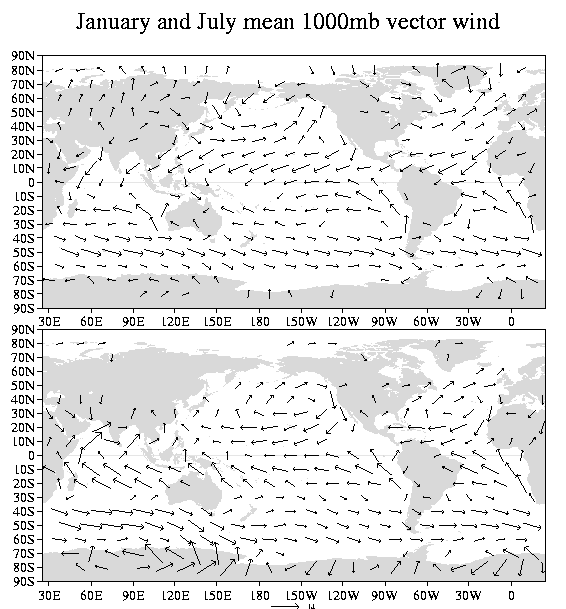
Annual mean and seasonal surface winds
- Annual mean:
- January and July surface wind:
- Digital values for this climatology are available as netCDF files:
Averages for individual calendar months, the annual mean, and the standard meteorological seasons are available on these files.
Landform data: Maps of topography and water bodies
Climate zones for the world's land regions (sans Antarctica)»
Please report problems or corrections to DATA webmaster: Todd Mitchell <mitchell@atmos.washington.edu>.