| Latitude 47° 2´N |
Longitude 68° 36´W |
Elevation 186 meters |
 COOP Northeast |
 Maine |
Help Main |

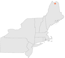
| 14 mi | N : | FORT KENT, ME |
| 15 mi | N : | FORT KENT 2, ME |
| 17 mi | WNW : | ST FRANCIS, ME |
| 20 mi | W : | ALLAGASH, ME |
| 28 mi | NE : | GRAND ISLE, ME |
| 29 mi | ESE : | CARIBOU MUNICIPAL ARPT, ME |
| 33 mi | ENE : | VAN BUREN 2, ME |
| 35 mi | SE : | PRESQUE ISLE MUNICIP, ME |
| 36 mi | SSE : | SQUA PAN DAM, ME |
| 39 mi | SE : | PRESQUE ISLE, ME |